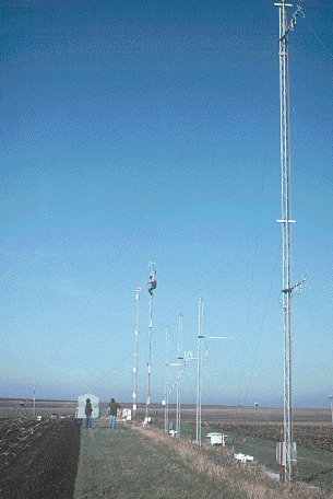
FLATLAND96
Flatland Observatory Project II
The 1996 Flatland Atmospheric Boundary Layer Experiment, FLATLAND96, was an investigation of the structure and dynamics of the planetary boundary layer.
Objectives:
- To measure entrainment velocity in the convective boundary layer
- To measure the spatial and temporal variations of boundary layer height
- To measure the thickness and time evolution of the entrainment zone
- To measure the turbulent heat flux
- To measure temperature advection term of the heat budget
- To measure heat storage term of the heat budget
- To measure or estimate the boundary layer-top heat flux and entrainment parameter.
- To compare cloud-topped and cloud-free boundary layers
- To measure surface flux differences between corn and soybean fields
In addition to the scientific objectives, FLATLAND96 also served to develop instrumentation and methodology. The associated instrumental and technique objectives were:
- To characterize the accuracy and precision of boundary layer height measurements
- To compare turbulent heat flux measurement techniques (similarity, eddy correlation, conditional sampling)
- To compare direct vertical velocity measurements to those from divergence
- To prepare for the 1997 soil flux study
- To compare radar and lidar measurements of boundary layer structure and winds
- To improve understanding of scattering mechanisms
These scientific and methodological objectives were to be achieved by using the following instruments and data sets:
- Profilers: Three 915-MHz boundary layer radar wind profilers were deployed in a triangle. Two Integrated Sounding Systems from the NCAR facilities pool were deployed in addition to the existing FAO profiler.
- Surface meteorology stations. The two ISSs and the FAO base had surface meteorological instruments measuring wind speed and direction (at 10 m), temperature, humidity, and rainfall.
- Flux-PAM: Three Flux-PAM systems from the NCAR facilities pool were deployed to measure surface fluxes. One Flux-PAM augmented with components of the ASTER facility was equipped with a fast-response ozone sensor for measuring surface ozone flux during the latter part of the campaign.
- Rawinsondes: Rawinsondes were flown from one of the two ISSs as described below.
- Ceilometer: A Vaisala CT-25K laser ceilometer was deployed at FAO to provide cloud base and backscatter profile information. This became a permanent instrument at FAO.
- Lidars: Three lidars from NCAR and NOAA were deployed at the Monticello Road site 26 July - 15 August in a separate project known as LIFT.
The profiler triangle sites were chosen based on a number of factors, including the precision of divergence measurements, scale of processes to be measured, horizontal homogeneity, ability to compare results from three instruments, ability to use RASS (full-time if possible), and logistics. The triangle is the same as used in the Flatland95 campaign, with legs approximately 5.5, 7.5, and 8 km.
