NOREASTER
Nor'easter
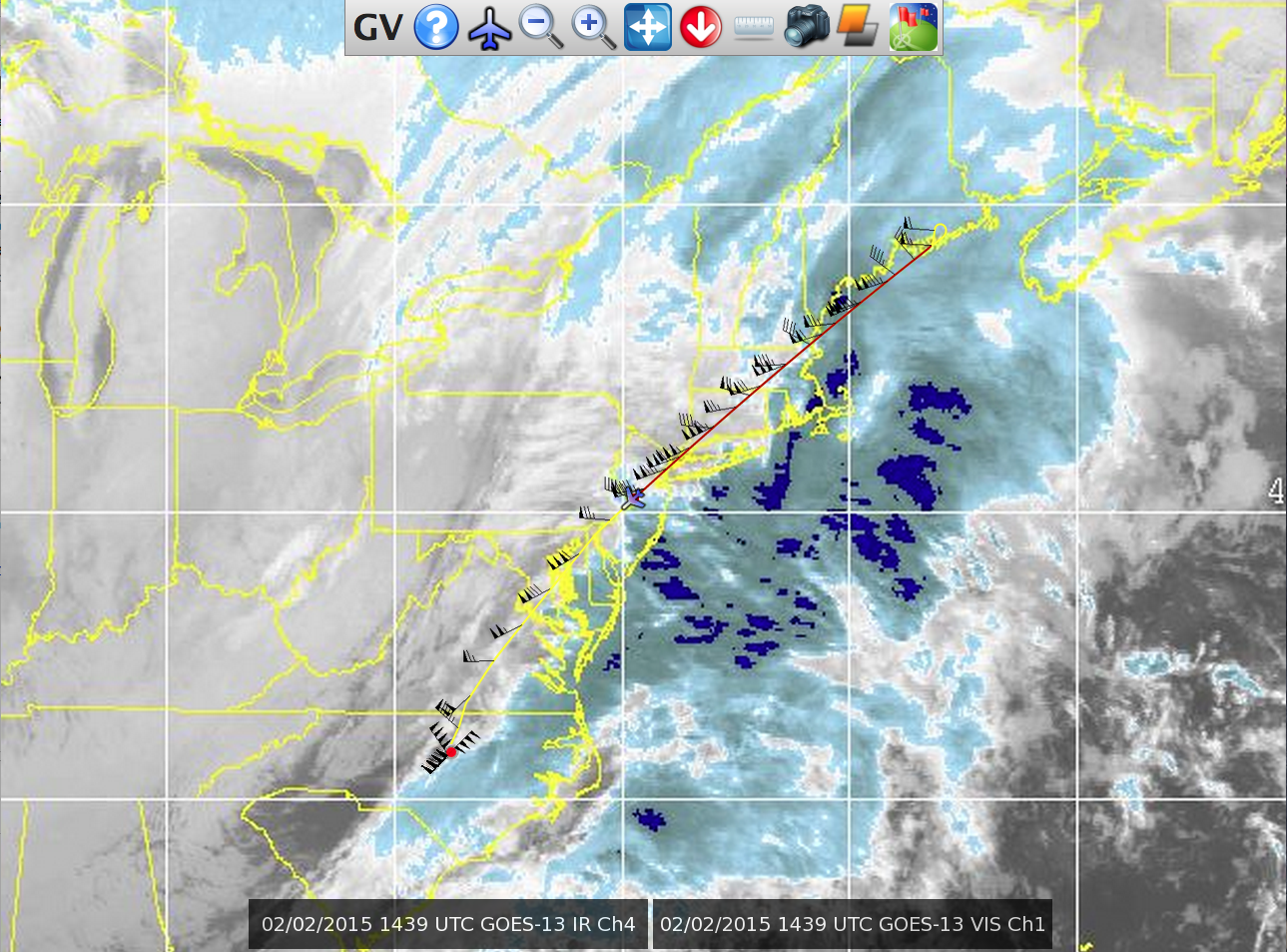
Nor'easter consists of a single flight on the NSF/NCAR HIAPER Gulfstream-V research aircraft to fly the HIAPER Cloud Radar (HCR) across the comma head of a strong Nor'easter cyclone in an attempt to determine unambiguously whether or not generating cells exist in these storms, and what their role is in snow production and banding, via high resolution measurements across the comma head with vertically pointing radars.
Cyclones forming along the U.S. East Coast typically are exceptional snow producers. With the additional moisture and heat provided by the Atlantic, they have conditions more conducive to convection compared to their continental counterparts. They also have widespread stratiform cloud shields, and well documented banded structure. The HIAPER research flight will provide a unique scientific opportunity to obtain the data necessary to investigate the relationship between elevated convection, generating cells aloft, precipitation streamers generated by the cells, and banded precipitation. The data analysis will use techniques the Rauber group, from University of Illinois, Urbana-Champaign, developed for processing airborne radar data during PLOWS, which will help EOL's Remote Sensing Facility further assess the performance of the HIAPER Cloud Radar in preparation for CSET deployment in summer 2015.
Nor'easter in the News
Nor'easter on the Radar
AtmosNews | 9 February 2015
The dual-polarization radar, developed at NCAR with funding from NSF, is a compact instrument that uses millimeter-long wavelengths of energy to provide highly detailed views of the atmosphere. It distinguishes between ice, water, and supercooled water droplets (droplets that exist as a liquid below freezing), measures thin ice and liquid clouds, and takes advanced wind measurements.
» Read more
Advanced radar makes maiden voyage from RDU
WRAL.com | 2 February 2015
While many spent Groundhog Day looking beneath the ground for the forecast, scientists were soaring high above in search of better forecasts. A research team from the University of Illinois and the National Center for Atmospheric Research (NCAR) took a specially-equipped Gulfstream V plane from RDU and flew over the winter storm pounding New England.
» Read more
Principal Investigators:
Bob Rauber University of Illinois
Project Manager:
Lou Lussier NCAR/EOL/RAF
Data Manager
EOL Archive, NCAR/EOL/DMS


