CaPE
Convection and Precipitation/Electrification Experiment
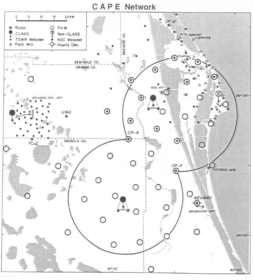
The Convection and Precipitation/Electrification Experiment (CaPE) was conducted in the central Florida region during the period 8 July through 18 August, 1991. The CaPE was a cooperative multi-agency field project sponsored by the National Science Foundation (NSF), Federal Aviation Administration (FAA), National Aeronautics and Space Administration (NASA), National Oceanic and Atmospheric Administration (NOAA), and the United States Air Force (USAF).
(Click Image for Full Resolution)
Science Objectives
The CaPE focused on five main objectives that have been the basis of extensive research activity in recent years:
- Identification of the relationships among the co-evolving wind, water, and electric fields within convective clouds
- Determination of the meteorological and electrical conditions in which natural and triggered lightning can (and cannot) occur, and understanding the initiation and propagation of lightning
- Development of mesoscale numerical forecasts (2-12 hour) of wind, clouds, and thunderstorms, employing data assimilation
- Improving techniques for performing short period forecasts (nowcasts < 2-hour) of convection initiation, downbursts, and tornadoes
- The characterization of precipitation particles and remote estimation of rainfall
Project Operations
The CaPE was held in Florida for a number of reasons:
- Central Florida has the highest annual number of days with thunderstorms in the U.S.;
- the regularity of the boundary layer forcing by sea breeze fronts leading to convection and the associated electrical activity;
- Other concurrent field projects (FAA FLOWS, NASA space vehicle launch meteorological support, and NOAA Tampa Bay Oceanography Project) were operating in Florida to leverage enhanced observations; and
- Central Florida made possible a cooperative nowcasting experiment between meteorologists from the Air Force (Kennedy Space Center), the Melbourne National Weather Service (NWS) and the Research Applications Program (RAP) of NCAR.
(Click Image for Full Resolution)
Facilities
| Aircraft | ER-2 (NASA); Sailplane (NCAR); King Airs (NCAR and University of Wyoming); Learjet (NASA); T-39 (NASA); T-28 (SDSM&T); and P-3 (NOAA) |
| Radar | CP-2, CP-3, CP-4 (NCAR); FL-2, FL-3, UND (FAA TDWR); Tampa Bay RADAP (NOAA/NWS); Patrick AFB radar (USAF); NMINT mobile radar (New Mexico Tech); and P-3 aircraft (NOAA) |
| Surface | PAM network (NCAR), FLOWS mesonet (MIT); LLWAS and AWOS (FAA); WINDS Towers (NASA/USAF); SEBN and TRMM networks (NASA); Florida Water District precipitation networks (SJRWMD/SFWMD/SWFWMD); Fire Network (Florida Division of Forestry); Agricultural Network (University of Florida); and routine operational NOAA and USGS networks |
| Upper Air | CLASS network (NCAR); MSS and RATS stations (USAF); Rawinsonde station (University of Lowell); Minisonde station (North Carolina State); and KSC Profiler (NASA) |
| Electrical | Surface Electric Field Mill (NASA); Airborne Electric Field Mill (SDSM&T/NCAR/NASA); LDAR (NASA); RTLP Program (NASA); Wideband Electric Field-Change (NMIMT); Interferometer (ONERA/NMIMT); VHF and Wideband TOA (University of Florida); Corona Point (MIT); Lightning Photography (NOAA/SUNYA); and National LLP network |
|
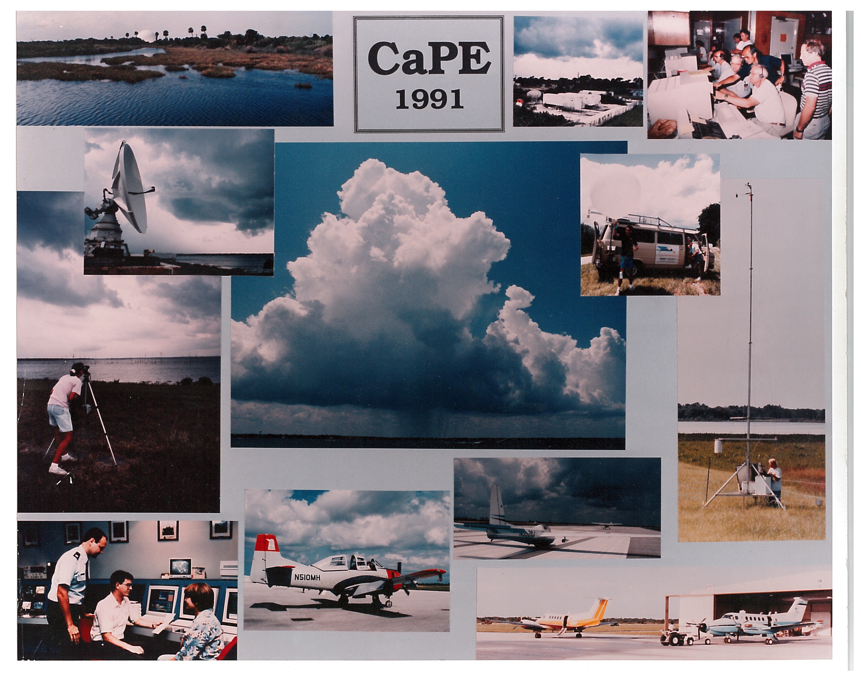
CaPE data: reflectivity plot. Photo courtesy UCAR.
|
Tammy Weckworth, a graduate student at the time, monitoring cloud formations from within one of the data sites on District property near Melbourne. Photo courtesy Carlos Rodriguez.
|
Photo courtesy Bob Bumpas.
|
Chester McNeese of the FAA's Miami center briefs Teddie Keller (left, NCAR's RAP), sailplane pilot Bruce Miller, and Glenn Gordon (University of Wyoming) on air traffic routes in the CaPE area.
|
All photos copyright University Corporation for Atmospheric Research unless otherwise noted.


