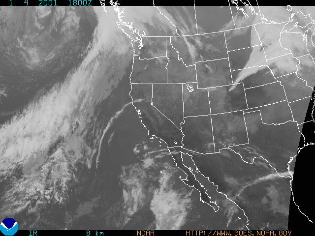
IOP 1: 04 January 2001
Time Period of IOP
1400 UTC 04 Jan 2001 - 1130 UTC 05 Jan 2001
Overview of IOP
A forecast model run on (Wednesday) 03 Jan indicated that a "stubby" warm front would pass through the study area during early afternoon on the 04 Jan, followed by a cold front in the evening. A decision was made to call for a Convair-580 flight on 04 Jan with an aircraft doors close time of 1100 local time in order to sample a warm frontal precipitation band as it approached the coast. That doors closed time was adhered to, and the aircraft flew offshore to intercept the approaching precipitation system. When the Convair-580 arrived on station, the warm frontal precipitation had already moved northeast of the study area, so the aircraft flew a few legs in what seemed to be warm sector rainbands. However, the plane was returned to base after a brief flight, due to lack of precipitation offshore, and problems with air traffic control and instruments. Heavy rain occurred later on 04 Jan on the south slopes of Olympics Mountains prior to cold frontal passage. The S-Pol radar was operated overnight to observe the cold frontal passage on the coast, which occurred at ~0900 UTC on (Friday) 05 Jan.
Convair-580 Summary
UW Flight Number:
1846
Period of Flight:
1907-2138 UTC, 04 January 2001
Main Accomplishments of Flight:
Measurements in warm-sector rainbands producing light to moderate and steady precipitation.
Instrument Problems:
PMS 1-D and 2-D cloud probes and SPEC HVPS. SPEC CPI not aboard.
Flight Scientist:
Nick Bond
Approximate UTC Timeline (Local time = UTC – 8 hours) Activity for UW Flight 1846:
1907 Engines on at Paine Field
1916 Take off.
1932 Ferry to original point. In precipitation.
1942 Temporarily out of precipitation.
1950-1953 Communications with S-Pol.
1953 Spiraling down for first pass in precipitation.
2000 N. winds.
2003 Minor white capping.
2010 Low-level 300 ft run in light to moderate precipitation.
~2020 Spiraling up at west end.
2030-2040 Problems with 2D-C probe.
2040 Spoke with S-Pol. Tentatively planning cutting short due to equipment problems.
2048 Communications with S-Pol. Cutting flight short. Climbing to 15,000 ft for ferry back to Paine Field.
2059 Approaching tops near 15,000 ft. Descended due to cabin pressure to 13,000 ft.
2106 Still in light precipitation.
210644 A burst of 2D imagery. ~–5 C, winds look okay, 230 at 31 m s–1.
2112 Freezing level at ~8,000 ft.
2120 Drift angle looks suspicious. Winds 20-25 m s–1 at 4,000 ft then 36 m s–1.
2130 Liquid H2O probes off.
213130 Touch down at Paine Field
2137 Engines off.
S-Pol Radar Summary
Scan cycle switched from NWS-Surveillance to Long Range.
1900 UTC Thur 04 Jan:
Scan cycle switched from Long Range to Research.
1000 UTC Fr 05 Jan:
1130 UTC Fr 05 Jan:
Summary of Navy Sonde Launches from Westport
2215 UTC Thur 04 Jan
0314 UTC Fr 05 Jan
0557 UTC Fr 05 Jan
0922 UTC Fr 05 Jan
1120 UTC Fr 05 Jan
Note: An attempted launch at 1800 UTC Thur 04 Jan failed for unknown reason.
Summary of NWS Sonde Launches from Quillayute (UIL) and Salem (SLE)
1 h before the standard synoptic hour.
UIL Launch Times:
2000 UTC Thur 04 Jan (special)
0000 UTC Fr 05 Jan (standard)
0200 UTC Fr 05 Jan (special)
SLE Launch Times:
1800 UTC Thur 04 Jan (special)
2100 UTC Thur 04 Jan (special)
0000 UTC Fr 05 Jan (standard)
0300 UTC Fr 05 Jan (special)
IMPROVE (University of Washington)
