IOP 7: 23 January 2001
Time Period of IOP
0542 UTC 23 Jan 2001 - 1747 UTC 24 Jan 2001
Overview of IOP
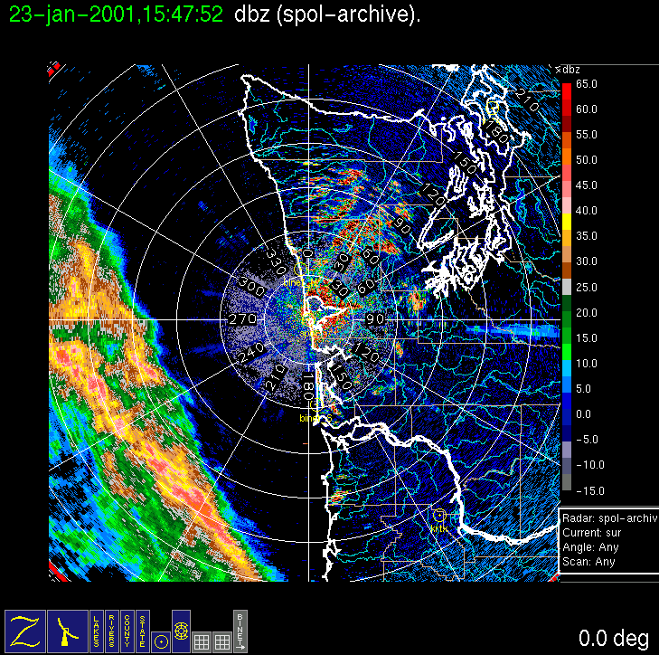
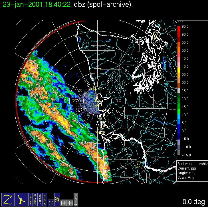
On (Monday) 22 January forecast models were developing a cut-off low-pressure system on Tuesday, which was forecast to pass to south of the study area along a southeastward trajectory into Oregon/California. A few precipitation bands associated with this system were forecast to move northeastward into the study area Tuesday afternoon, although the models showed them to be weak, and becoming weaker with time, essentially disintegrating before reaching the coast. On the chance that such bands might be stronger and more persistent than most of the models indicated (as suggested by the AVN model), a Convair-580 flight was planned for Tuesday, with a local noon doors closed time. As with IOPs 5 and 6, an early morning examination of the radar surveillance scan indicated that a large and very well-formed rainband had already developed ~100-200 km offshore. The aircraft crew were hastened in their preparations, and the Convair-580 took off shortly after 10 am local time on Tuesday 23 January. The aircraft intercepted the band at its strongest point (with maximum reflectivity of 40 dBZ). While the Convair-580 transected the band at several levels up to 24,000 ft, a second rainband formed behind the first and overtook it. first. However, the Convair-580 finished its work on the first rainband, and it was decided to send it back to Paine Field, instead of working the second band, and/or waiting at Hoquiam for another model-forecasted band to materialize back at the trailing surface trough/wind-shift line, which at that point was not within radar range.
Convair-580 Summary
UW Flight Number:
1854
Period of Flight :
1805-2158 UTC, 23 January 2001
Main Accomplishments of Flight:
Measurements in a quasi-stationary rainband ahead of a low-level frontal (cold?) windshift line.
Instrument Problems:
Delayed start-up of SPEC CPI.
Flight Scientist:
Art Rangno
Approximate UTC Timeline (Local time = UTC – 8 hours) Activity for UW Flight 1854:
1805 Engines on.
1817 Take off from Paine Field
1835 Descending for low-level run. Freezing level ~6,000 ft.
1846 Begin low-level (1,000 ft) run. Temperature ~7 deg C.
1853 Start of precipitation.
1905 End of low-level/climbing.
1909 Start of 6,000 ft run.
1914 Dropping to 5,500 ft. CPI out.
1927 End of 5,500-6,000 ft run.
1930 Start of 8,500 ft run.
1942 End of 8,500 ft/climb. Some CPI data.
1946 Start of 11,500 ft.
2000 End of 11,500 ft.
2003 Start of 14,500 ft. CPI okay.
2014 Out of precipitation for 1-2 min.
2017 End of 14,500 ft.
2022 Start of 17,500 ft.
2036 End of 17,500 ft.
2041 Start of 20,500 ft.
2054 End of 20,500 ft.
2056 Return at 21,000 ft.
2057 Checking for clearance to ascend.
2100 Ascending to 24,000 ft.
2106 Begin 24,000 ft.
2119 End of 24,000 ft.
2152 Touch down Paine Field
2158 Engines off.
S-Pol Radar Summary
Scan cycle switched from NWS-Surveillance to Long Range
(with RHIs after 1619 UTC).
1800 UTC Tues 23 Jan:
Scan cycle switched from Long Range to Research.
1747 UTC We 24 Jan:
Summary of Navy Sonde Launches from Westport
0127 UTC We 24 Jan
Note: Attempted launch at 1800 UTC Tues 23 Jan failed for unknown reason. Summary of NWS Sonde Launches from Quillayute (UIL) and Salem (SLE)
UIL Launch Times:
0200 UTC We 24 Jan (special)
0600 UTC We 24 Jan (special)
SLE Launch Times:
0000 UTC We 24 Jan (standard)
0300 UTC We 24 Jan (special)
0600 UTC We 24 Jan (special)
Note: UIL sonde at 2100 UTC not launched due to equipment problems.
IMPROVE (University of Washington)

