IOP 1: 28-29 November 2001
Time Period of IOP
1200 UTC 28 Nov-0300 UTC 29 Nov
Overview of IOP
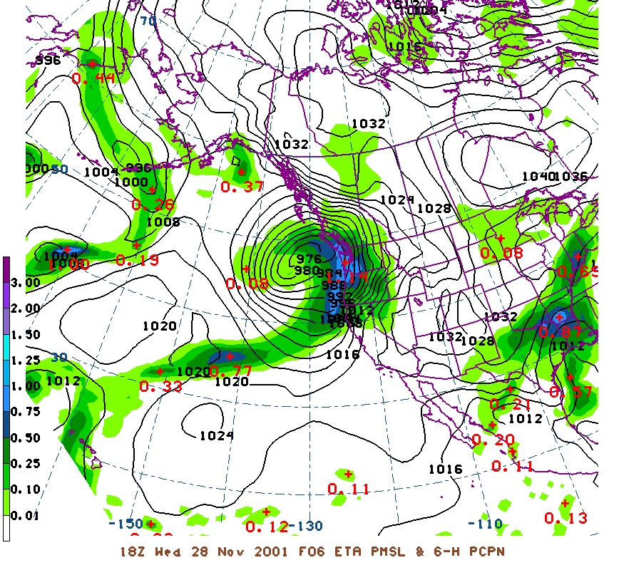
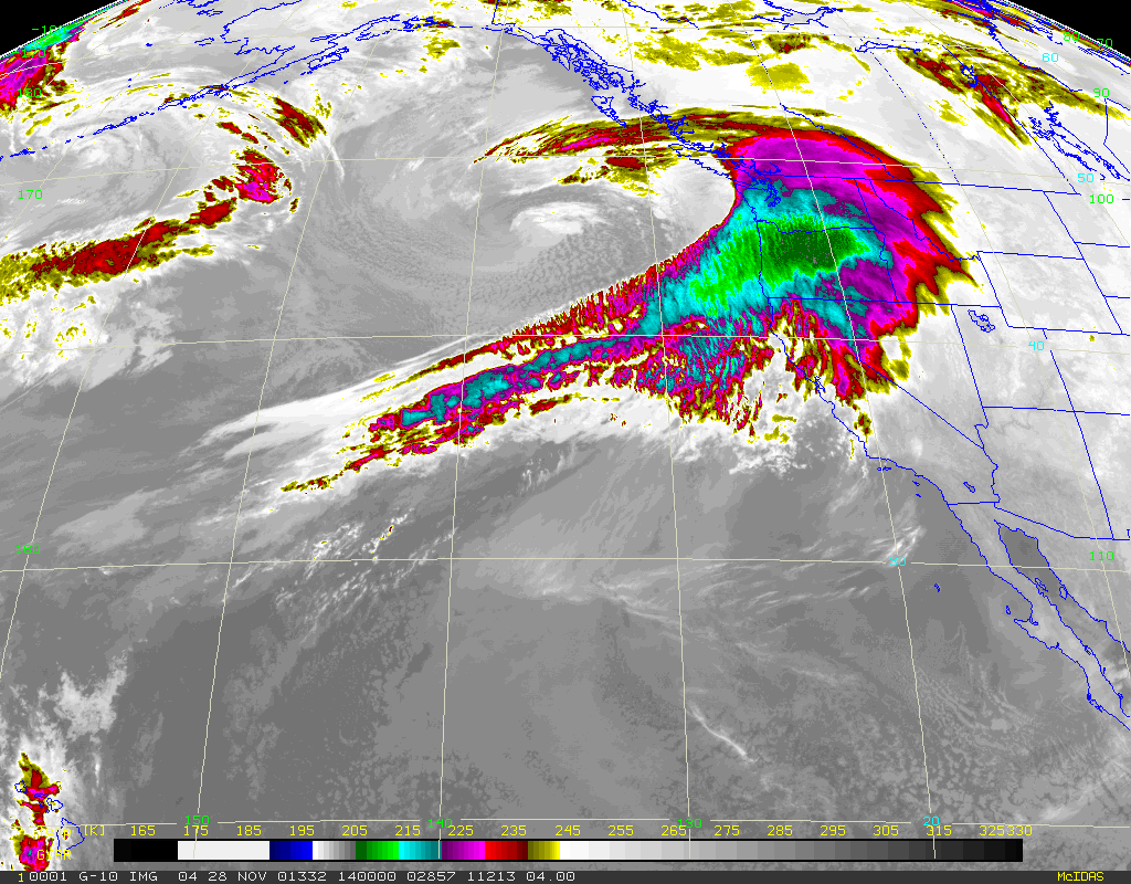
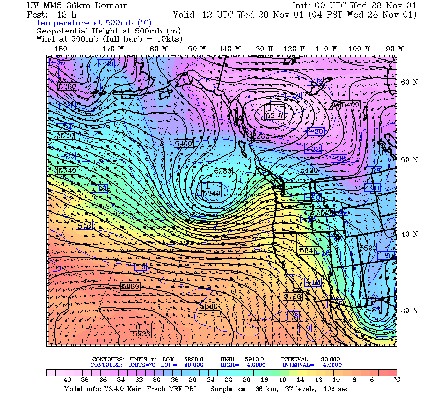
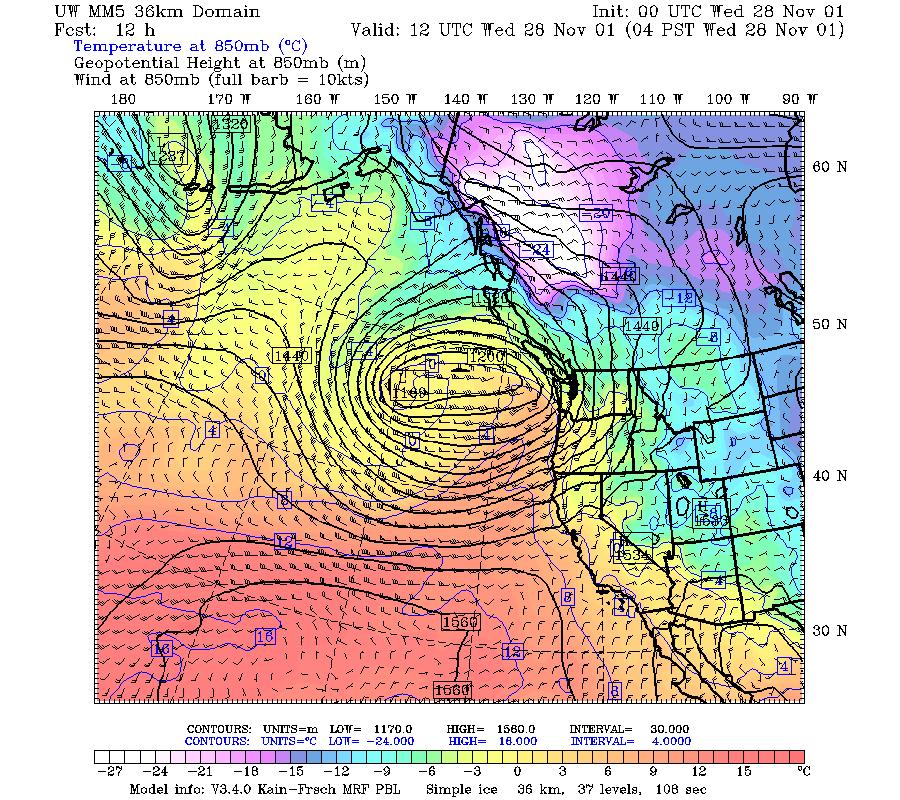
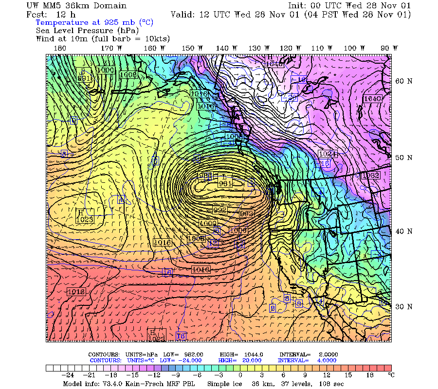
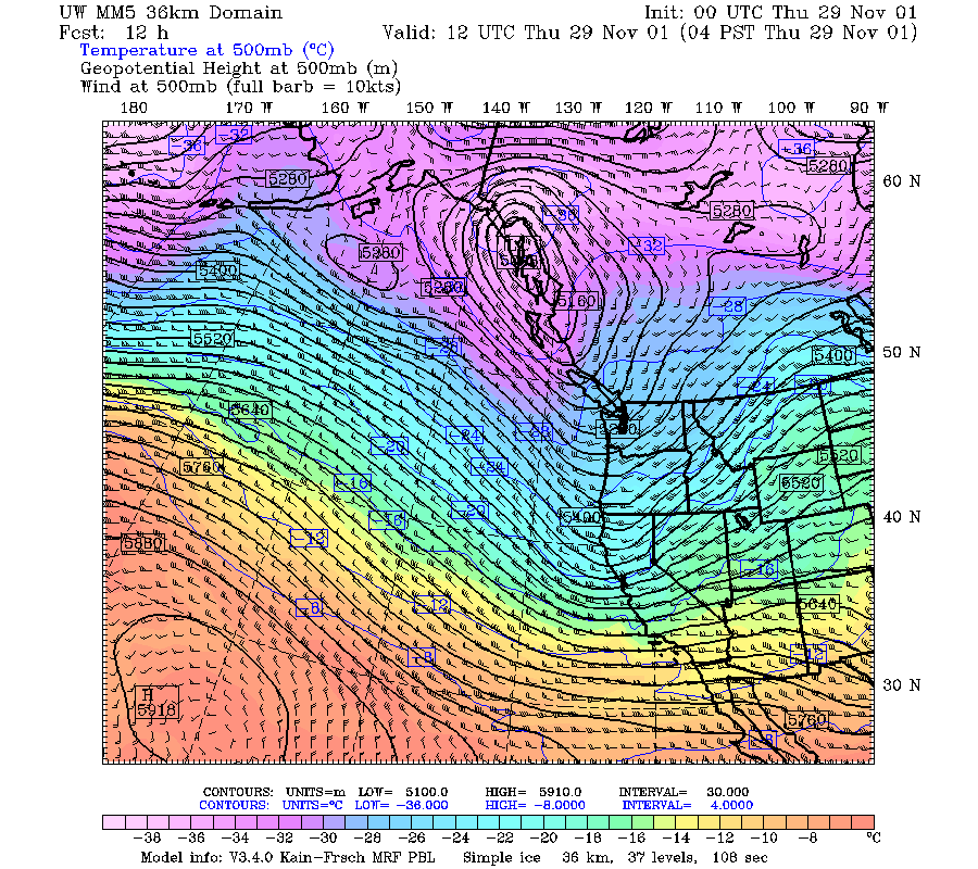
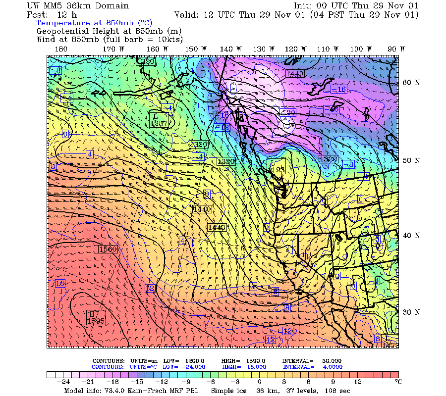
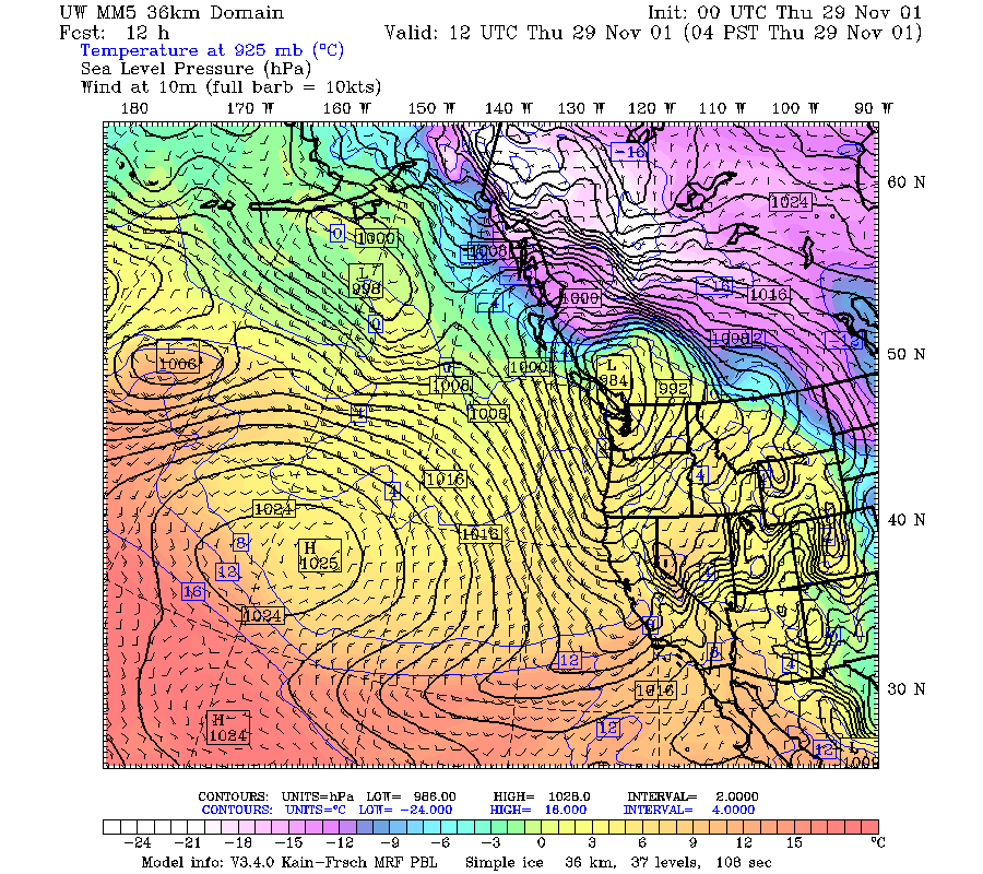
A very intense short wave trough formed over the
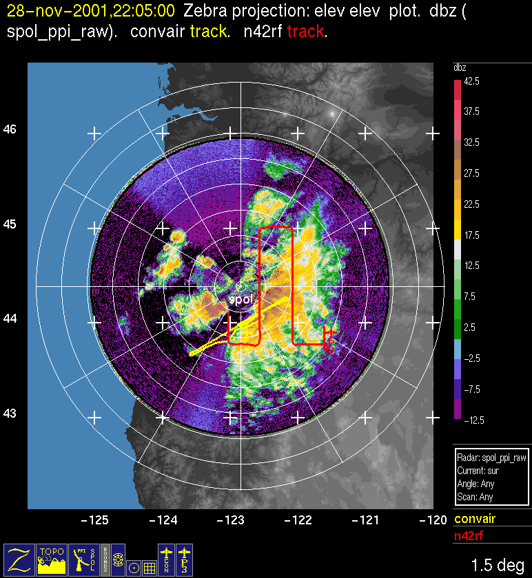
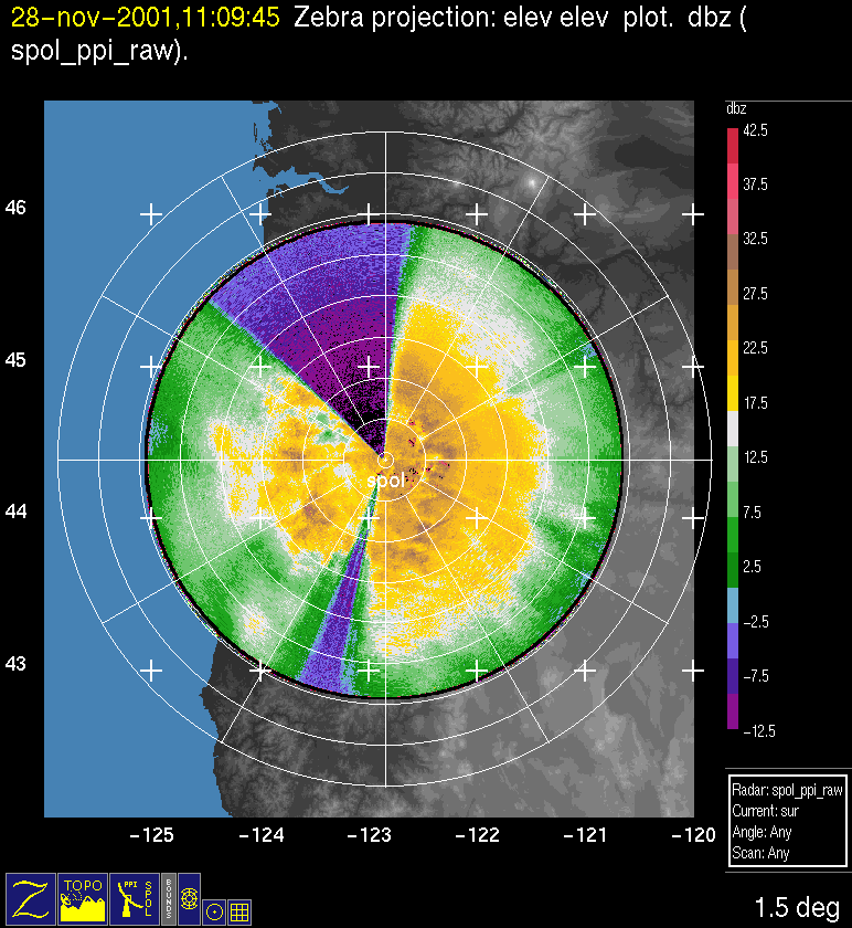
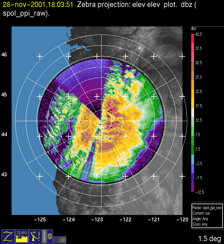
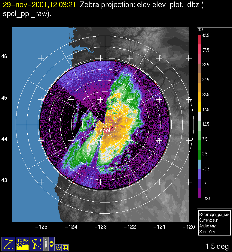
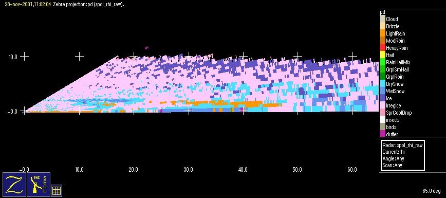
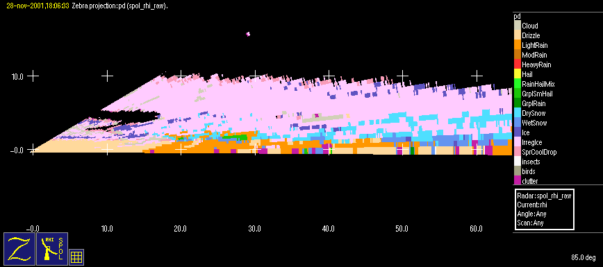
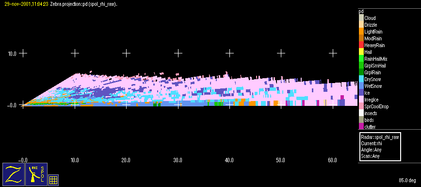
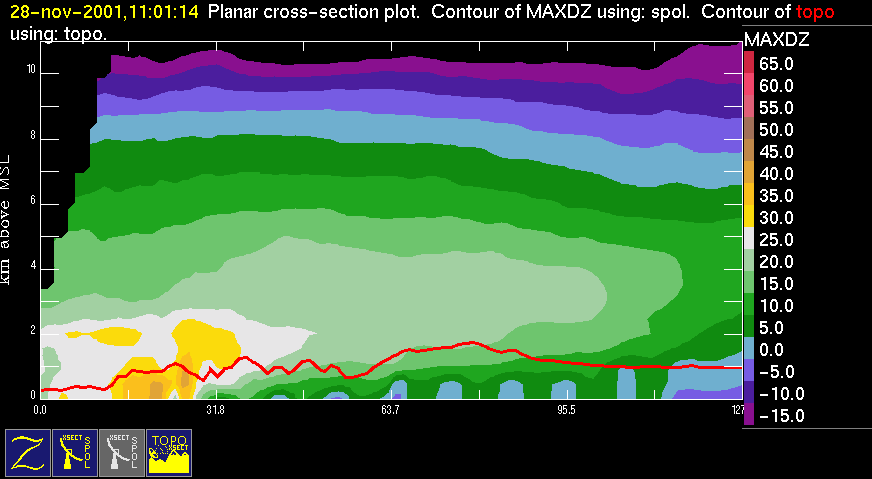
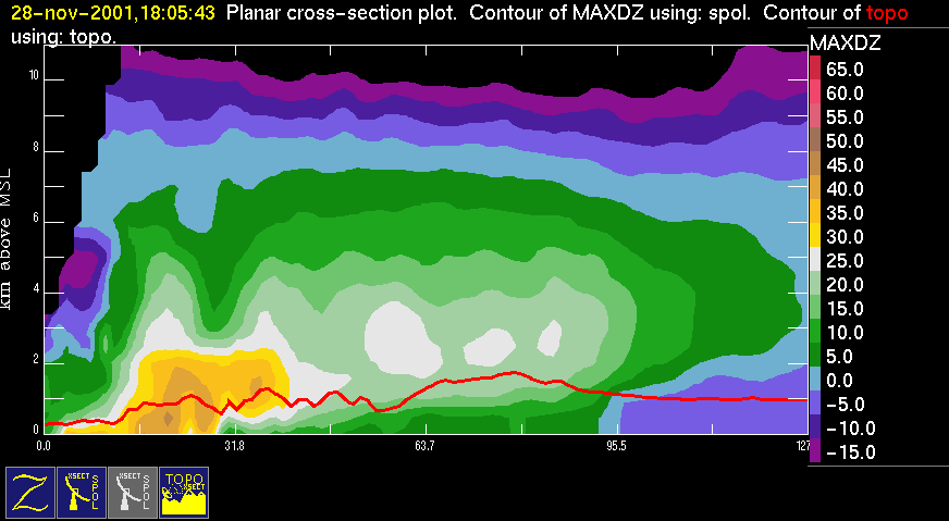
The S-Pol radar showed precipitation moving through the Oregon Cascades from 0400 UTC
After the cold front passed through
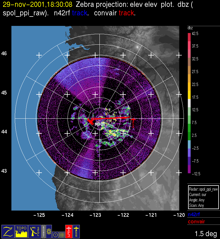
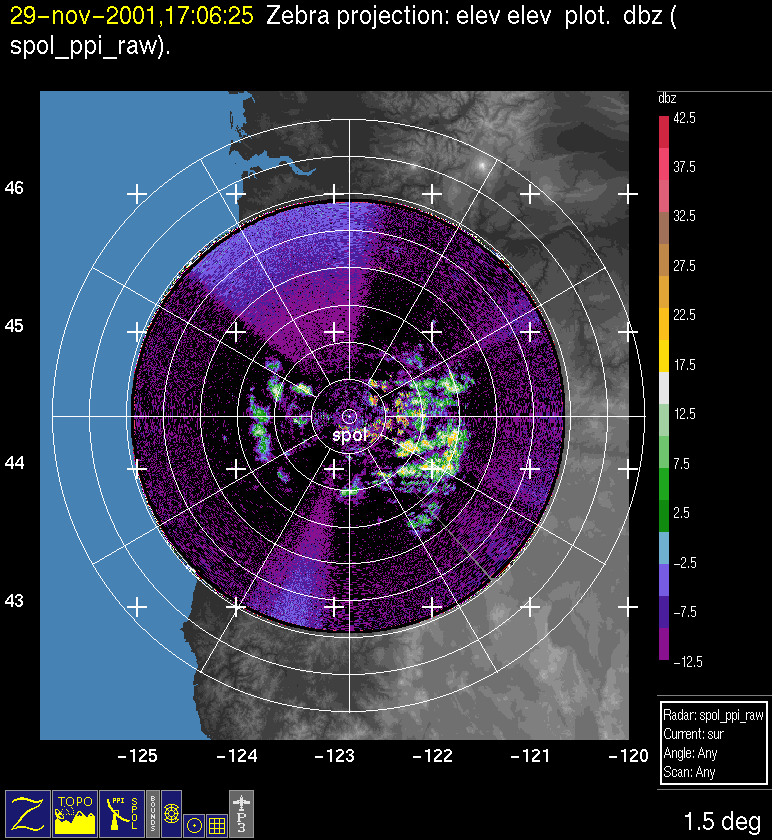
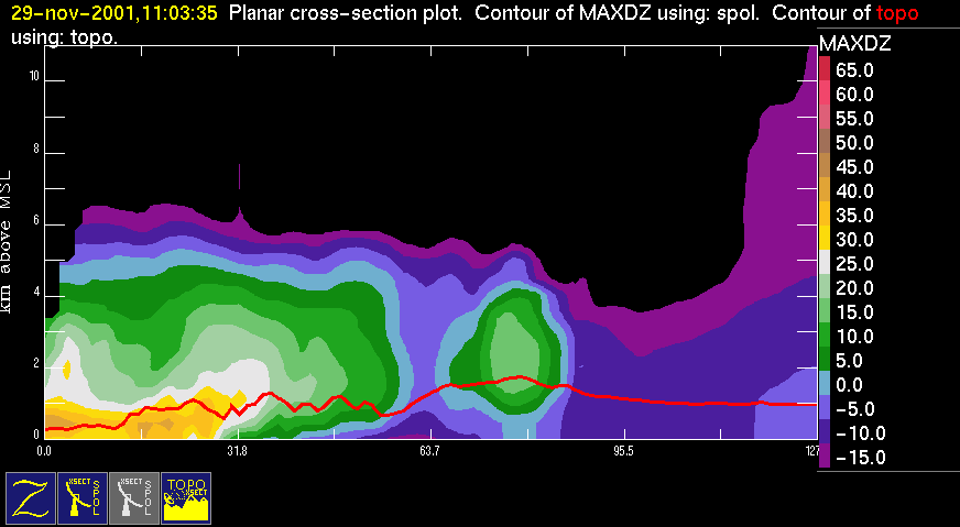
After 1600 UTC 29 November there were a few decaying convective cells to the east of the radar Fig. 16. From 1700-1922 UTC 29 November, the Convair flew a vertical profile for microphysical measurements over
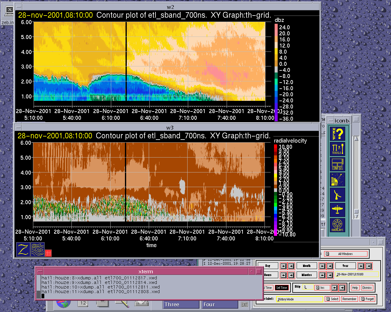
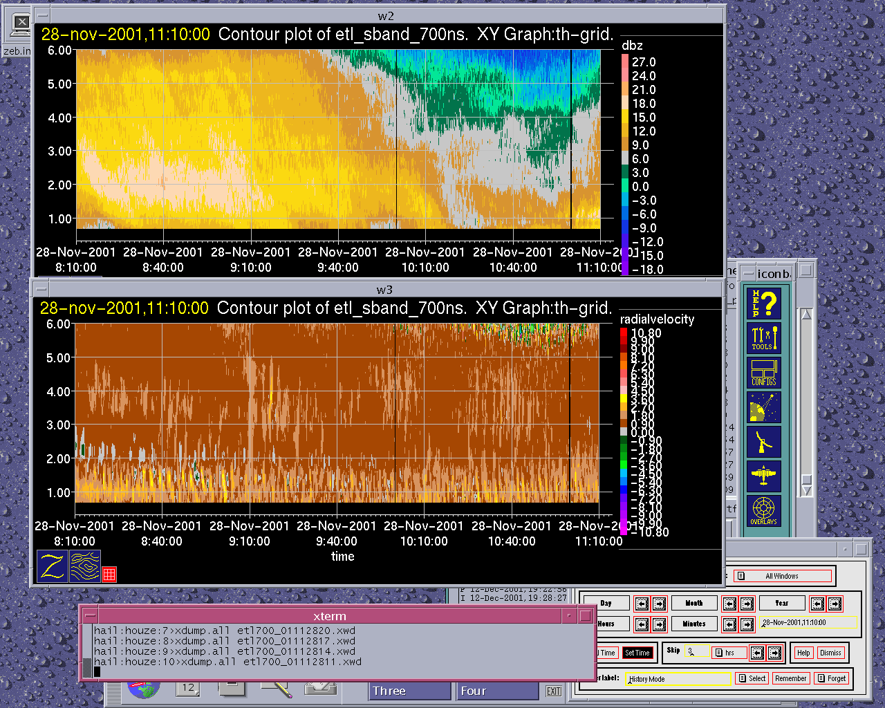
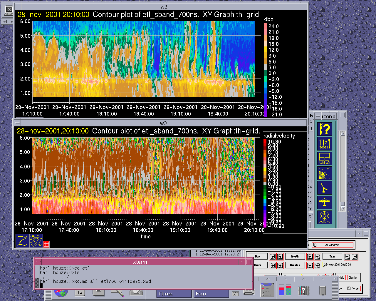
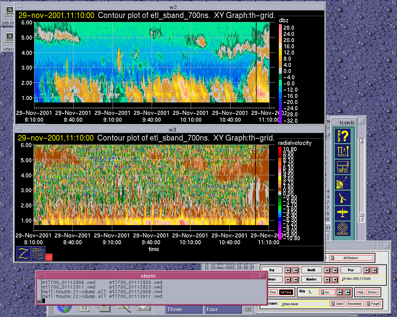
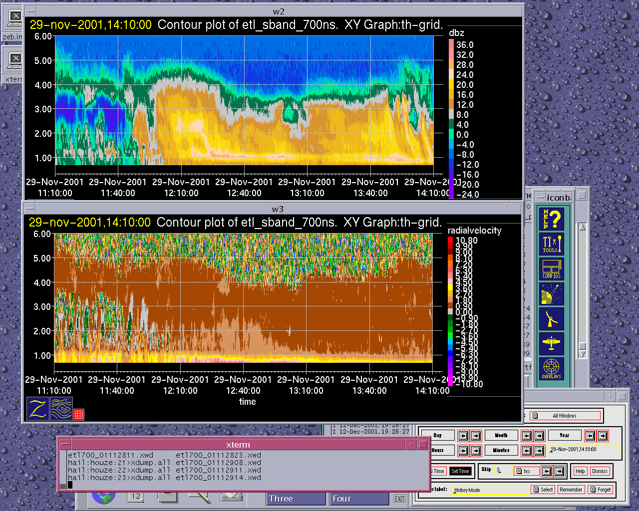
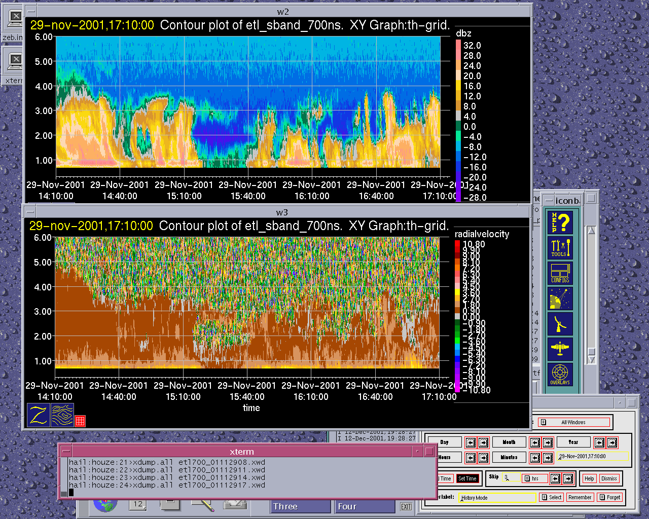
The ETL S-band vertically-pointing radar showed detailed vertical and horizontal structures during the passage of the storm over
Convair-580 Summary
UW Flight Number:
1891
Period of Flight:
1810-2329 UTC,
Main Accomplishment of Flight:
Measurements in pre-frontal, frontal and postfrontal conditions across the Oregon Cascades. Landed in
Instrument Problems:
SPEC CPI,
Flight Scientist:
Peter V. Hobbs
Approximate UTC Timeline (Local time= UTC-8 hours) Activity for UW Flight 1891:
1822 |
Takeoff from Paine Field |
1822-2015 |
Transit to |
2035-2048 At 43˚16.1'/124˚29. |
9' (on |
2048-2053 . |
NE --> SW descending |
2053-2107 . |
SW-NE at 19,500 ft |
2109-2132 |
NE --> SW descending to 17,000 ft. |
2134-2148 |
|
2149-3 |
NE --> SW descending to 14,500 ft. Picked up significant ice on descent to 14,500 ft. Circled in clear air at SW point to shed ice. |
~2225-2240 |
|
2240 |
Return to SW with slow descent (more icing in Cu). |
Land at |
|
2329 |
2330 Engines off. |
UW Flight Number:
1892
Period of Flight:
0011-0129 UTC,
Main Accomplishment of Flight:
Transit from
Instrument Problems:
As for Flight 1891.
Flight Scientist:
Peter V. Hobbs
Approximate UTC Timeline (Local time= UTC-8 hours) Activity for UW Flight 1892:
00?? |
Takeoff. |
0016-0031 |
Climb to 10,000 ft. Cloud tops |
UW Flight Number:
1893
Period of Flight:
1558-2039 UTC,
Main Accomplishment of Flight:
Vertical profile from 15,000 ft down to 2,000 ft between Sweet Home and Santiam Pass, Oregon, in postfrontal conditions. Measured CCN spectra in inflow to clouds over Cascades and in outflow. Profile through small cumulus clouds over PNNL PARSL site at
Instrument Problems:
Discrepancy between FSSP-100 and PVM-100. Intermittent outages of HVPS.
Flight Scientist:
Peter V. Hobbs
Approximate UTC Timeline (Local time= UTC-8 hours) Activity for UW Flight 1893:
1606 |
Takeoff. |
1606-1709 |
Transit to Sweet Home. |
1709-1725 |
Sweet Home à Santiam à 15,000 ft à 10,500 ft. No cloud at this height. |
1725-1750 |
Return to Sweet Home à descending to get into cloud tops, 10,000 ft à 5,000 ft à 2,000 ft. |
1755-1810 |
CCN spectra in inflow air to clouds just west of Santiam at 2,000 ft. |
1810-1830 |
West à Sweet Home à Santiam. |
1830-1855 |
To PARSL site. |
1857-1912 |
CCN spectra in outflow below cloud base near PARSL site. |
1914-1922 |
Spiral up over |
1922 . |
Transit home |
P-3 Summary
P-3 Flight Number:
011128H, IMPROVE 01
Period of Flight:
1936 UTC 28 November-0122 UTC
Main Accomplishment of Flight:
Support of UW Convair operations (SW-NE transect) over
Instrument Problems:
-
Flight Scientist:
Nick Bond
Approximate UTC Timeline (Local time= UTC-8 hours) Activity for P-3 Flight 01:
193613 UTC (47.90024, -122.28056) .755°, 965.6 mb, 3.0 m Engine Start
194312 UTC (47.90022, -122.28049) 5.593°, 965.0 mb, 3.0 m Block Out. Taxi to 16R
195517 UTC (47.90895, -122.28560) 179.130°, 968.6 mb, 5349.0 m Takeoff
195859 UTC (47.77825, -122.42265) 260.415°, 884.1 mb, 901.0 m Cloud physics system up but with some initialization problems.
200534 UTC (47.53393, -122.76604) 181.575°, 689.7 mb, 2593.0 m Radar system up, recording on DR1. Slewable (AOC) antenna. LF at 2 RPM.
201207 UTC (47.20762, -122.95032) 205.434°, 574.3 mb, 4289.0 m Tech swapping cards on precip/cloud probes to get data into proper size range. Echo tops near 6km.
201939 UTC (46.76801, -123.12292) 181.582°, 554.9 mb, 4436.0 m PMS data looked good as we came through echo last few min; now in clear. ETA Pt A is 2047UTC. Echoes thinning out here.
203124 UTC (46.07021, -123.10075) 175.955°, 556.5 mb, 4275.0 m Crossing Columia; echoes picking up, especially east of track
204001 UTC (45.53973, -123.02272) 175.024°, 561.6 mb, 4428.0 m Descending to 7kft, requesting 6kft. Echoes not too horizontally extensive, a little spotty, shallow.
204407 UTC (45.29348, -123.01978) 183.274°, 745.8 mb, 2191.0 m Tech bringing cloud physics back online. Top of BB near 2km.
204853 UTC (45.01687, -123.03389) 180.966°, 794.4 mb, 1774.0 m At Pt A, tracking 180. On tail view (out only to 40km range), echo generally more extensive west of track, tho some stuff hanging over Cascades to east.
205138 UTC (44.86903, -123.03319) 180.763°, 792.6 mb, 1691.0 m Passing over
205603 UTC (44.61491, -123.03305) 180.067°, 795.4 mb, 1733.0 m Echo picking up slightly to west of track.
210014 UTC (44.37672, -123.03346) 180.964°, 795.7 mb, 1719.0 m Some orographic enhancement/echo slant suggested on LHS. Cloud & precip probe data continue to look high quality. Melting aggregates, clusters of needles.
210737 UTC (43.97016, -123.03192) 179.703°, 795.6 mb, 1640.0 m Precip picking up as we
210917 UTC (43.87938, -123.03072) 178.763°, 795.4 mb, 1651.0 m Cold-frontal type shear (w/ suggestion of head structure) between 10-20 km range on LHS; some precip enhancement, but certainly no strong NCFR signature
211025 UTC (43.81692, -123.03029) 180.692°, 795.7 mb, 1625.0 m At Pt F, turning east, climbing to 9kft.Top of solid echos 3-3.5 km; top of BL near 2 km (round numbers)
211431 UTC (43.76334, -122.62691) 88.611°, 736.9 mb, 1098.0 m At Pt G, turning to track 360.Nice fallstreaks originating near 4-5 km.
211821 UTC (44.03061, -122.56519) .182°, 736.8 mb, 1827.0 m Continued fallstreaks w/evidence of generating cells
212338 UTC (44.43035, -122.56558) 359.102°, 736.6 mb, 1867.0 m Vr data show continued suggestion of cold-frontal type shear, immediately west of our track. Still no hint of NCFR enhancement however. Bulk of steady precip appears to be ahead of cold-frontal wind transition.
212718 UTC (44.71851, -122.56601) 1.039°, 736.7 mb, 2004.0 m Echoes again on the wane; perhaps general decrease of precip intensity to north, or alt. Tendency for SW-NE cold-frontal orientation putting best echoes farther east at north end of pattern.
213056 UTC (44.99189, -122.55467) 40.073°, 725.5 mb, 2200.0 m At Pt B, turning east & climbing to 11kft
213503 UTC (45.01260, -122.11125) 115.543°, 656.1 mb, 2077.0 m At Pt C, turning to track 180. Echo coverage more extensive to east of track.
213710 UTC (44.89366, -122.08392) 181.803°, 656.6 mb, 1972.0 m Some evidence of orographic enhancement (sharp western edge to heavier precip) 5-10 km west of our track. Tech took brief MPEG movie of tail showing frontal-like shear and associated west edge of frontal and/or orographic precip enhancement.
214242 UTC (44.54816, -122.08353) 179.451°, 656.2 mb, 2152.0 m Suggestion of KH waves at echo top to west of track last few min. More gen cells on RHS 2143-44. Some perturbations on J-W liquid water 2145-46.
215055 UTC (44.07003, -122.08437) 181.335°, 656.6 mb, 1670.0 m Picking up some significant rime ice on wings, J-W reaching ~0.5 g/kg
215303 UTC (43.94911, -122.08315) 179.848°, 656.5 mb, 2403.0 m Radar down at 2148:17. Lost de-ice on Prop #2, need to climb.
215510 UTC (43.82835, -122.08342) 181.248°, 656.4 mb, 2046.0 m Radar back up & recording on DR1. Convair will be at 14.5 kft, so we are requesting 16kft. At Pt H, turning east.
215937 UTC (43.77388, -121.64743) 89.487°, 572.1 mb, 3064.0 m At
220753 UTC (44.18489, -121.61774) .023°, 537.2 mb, 3475.0 m Nice visualization of precip spillover on crest to LHS. Echo dissipates totally 10-20 km east of our track.
221729 UTC (45.00552, -121.61293) 28.210°, 542.6 mb, 3719.0 m At Pt D. More precip extending east of our track here at north end, so will proceed with last leg (east-J).
222503 UTC (44.81872, -121.13411) 180.539°, 682.9 mb, 2419.0 m Now south-bound on east-J. Still at -6.1 oC, so not much hope of getting rid of ice. Fairly smooth even here in lee.
223217 UTC (44.36913, -121.13553) 179.246°, 682.9 mb, 2174.0 m Some echo on this leg, but not much, principally west of track, desert in view below. Planning J-K-G.
223621 UTC (44.11808, -121.12251) 179.916°, 682.8 mb, 2040.0 m Running out of echo, 5 min from turn. Shedding some ice here at –5 oC. Planning 10 kft J-K. Then climb to >13kft.
224244 UTC (43.74215, -121.11388) 123.986°, 682.9 mb, 1258.0 m At Pt J. Convair preparing to land for refueling; they had major icing issues, unsure if they want to execute 2nd pattern.
225306 UTC (44.26260, -121.47310) 322.695°, 683.2 mb, 2079.0 m Plan climb to FL 130 at K. Once again nice spillover coming off crest LHS
225459 UTC (44.36508, -121.55649) 356.377°, 654.3 mb, 2370.0 m At K, spiraling up. Consulted w/ Roles; suspended recording of Spectal Width and saved to IMPR1; according to Roles this will improve radar system stability (and save tape ;) Mix of pristine crystals (needles, dendrites) and amorphous forms as we climb.
230621 UTC (44.13600, -121.88629) 233.935°, 606.1 mb, 2316.0 m LF suggests increasing postfrontal activity (NNE-SSW bands?) immediately off shore. Some discussion of sticking with today's situation (vs. A separate flight tomorrow) to do postfrontal work.
231008 UTC (44.01292, -122.12607) 234.278°, 606.0 mb, 2636.0 m Elevated "secondary BB" feature exhibits top near our FL
232200 UTC (43.73032, -122.49013) 339.262°, 724.1 mb, 1865.0 m At Pt G. Turning to track 360. Dynamic slip pressure is iced up, so winds messed up, but can be corrected post-flight.
233106 UTC (44.37158, -122.57019) 1.593°, 735.5 mb, 2025.0 m Further suggestion of echo "plumes" coming off sloped terrain features to east (RHS) of our track past few min. However, echo definitely on wane as we proceed north abeam of less impressive terrain. Temps on this leg are running 3 °C cooler than 1st iteration.
234008 UTC (45.04402, -122.55222) 34.309°, 719.1 mb, 2224.0 m At Pt B, climbing to 11kft. Minimal shallow echoes here.
234417 UTC (45.09106, -122.12123) 103.131°, 655.0 mb, 2111.0 m At Pt C, turning to track 180.
000625 UTC (43.79105, -122.03868) 163.161°, 651.1 mb, 1831.0 m At Pt H, climbing to 13 kft. Precip once again picked up toward south end of pattern abeam of higher terrain
000950 UTC (43.71880, -121.70859) 87.814°, 606.4 mb, 2634.0 m At Pt I, turning to track 360. LF continues to suggest NNE-SSW banded structures--one roughly through our present location, and another more closely tied to coastal range, perhaps additional band(s) about 100 km offshore
001656 UTC (44.26968, -121.61063) 1.643°, 606.2 mb, 2874.0 m Just went through biggest bump of day, though nothing obvious on radar.
002258 UTC (44.75838, -121.61922) 359.929°, 606.3 mb, 2829.0 m Still has been suggestion of nice sloped (hydraulic jump?) type flow transition coming off crest on LHS
Will ferry Paine via Olympia at FL 140
002620 UTC (45.03315, -121.62498) 358.606°, 604.8 mb, 2752.0 m At Pt. D. Beginning ferry home.
002926 UTC (45.23274, -121.73640) 334.783°, 537.3 mb, 3658.0 m Switched to dual-PRF (3200/2133, Nyquist of +/- 48) for ferry. Setup file is MPRS1. Evidence of contaminated 1st trip echo (by 2nd trip) at 0034 etc etc.
004957 UTC (46.79881, -122.78369) 332.549°, 537.1 mb, 4679.0 m Radar system temporarily offline
010138 UTC (47.64162, -122.55238) 352.935°, 851.3 mb, 1146.0 m Back in echo, but no sign of 2nd trip, likely owing to low freezing level & absence of nearby terrain. Expecting 16R.
010848 UTC (48.11996, -122.34639) 67.652°, 884.8 mb, 779.0 m Secured radar system
011521 UTC (47.91954, -122.28584) 179.790°, 968.5 mb, 1.0 m Landed
S-Pol Radar Summary
The S-Pol radar was run continuously in the same mode of operation for the complete length of the field project.
Summary of
Launch times at:
1726 UTC 28 Nov
1813 UTC 28 Nov
2051 UTC 28 Nov
Summary of Leeside Sonde Launches
Launch times at: Black Butte Ranch, OR (a.k.a. ISS-3), Lat: 44.379, Lon:-121.679, Elev: 1027 m
1530 UTC 28 Nov
2100 UTC 28 Nov
0000 UTC 29 Nov
0250 UTC 29 Nov
Summary of NWS Sonde Launches from Salem (SLE)
Launch times:
1200 UTC 28 Nov (standard)
1500 UTC 28 Nov (special)
1800 UTC 28 Nov (special)
2100 UTC 28 Nov (special)
0000 UTC 29 Nov (standard)
0300 UTC 29 Nov (special)
Summary of Snow Crystal Ground Measurements
Measurement times:Every 15 minutes from
2330 UTC 28 Nov-0200 UTC 29 Nov (at
