IOP 16: 22-23 December 2001
Time Period of IOP
1200 UTC 22 Dec-0000 UTC 23 Dec
Overview of IOP
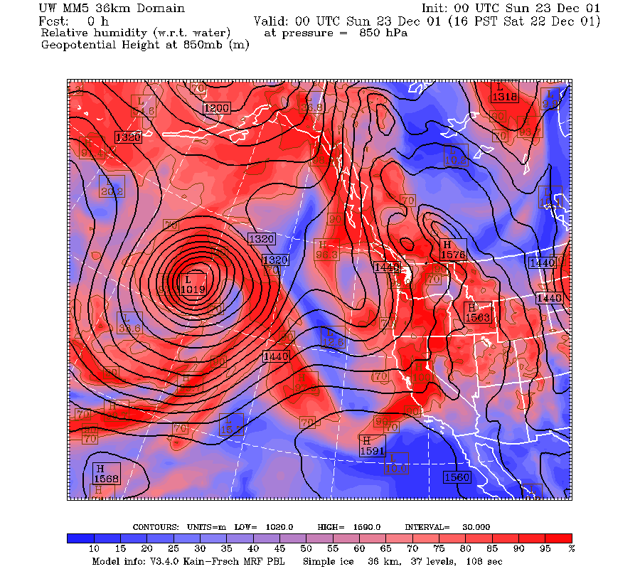
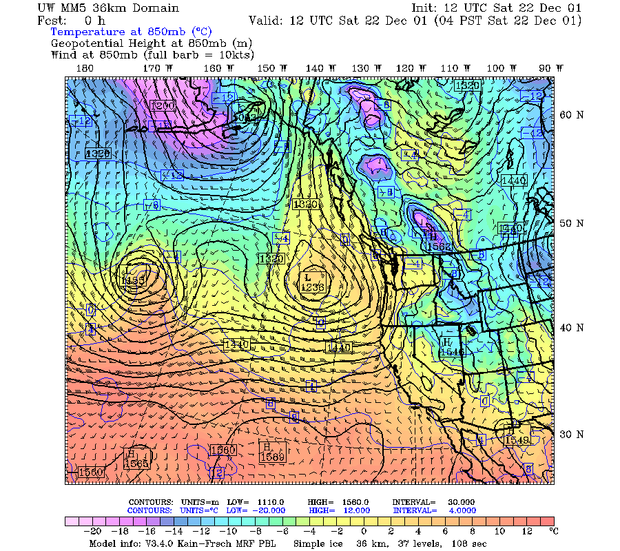
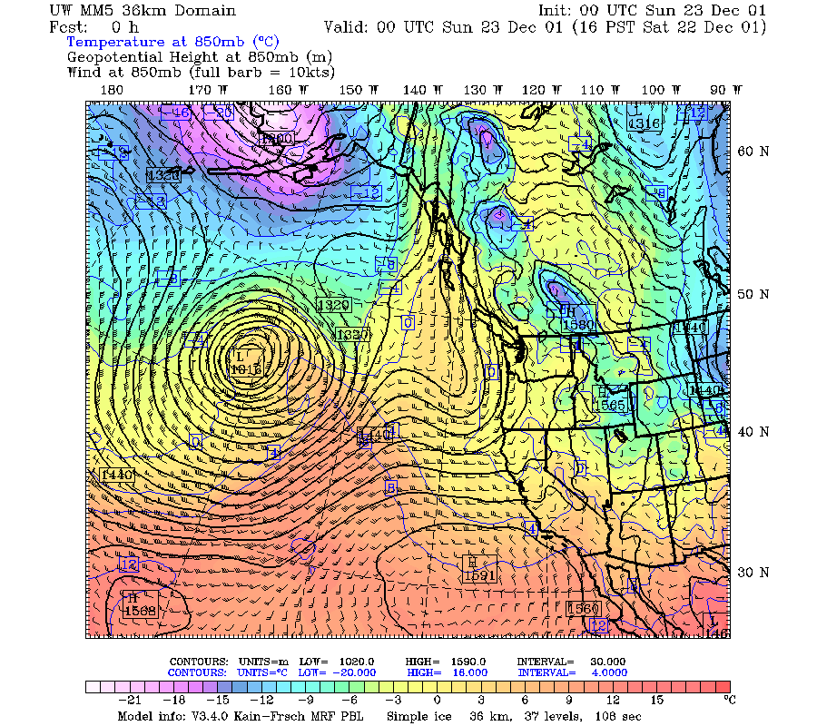
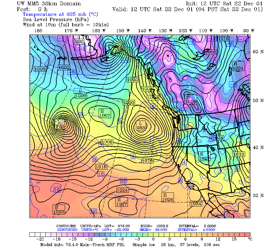
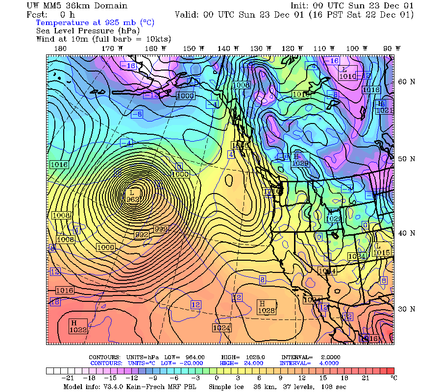
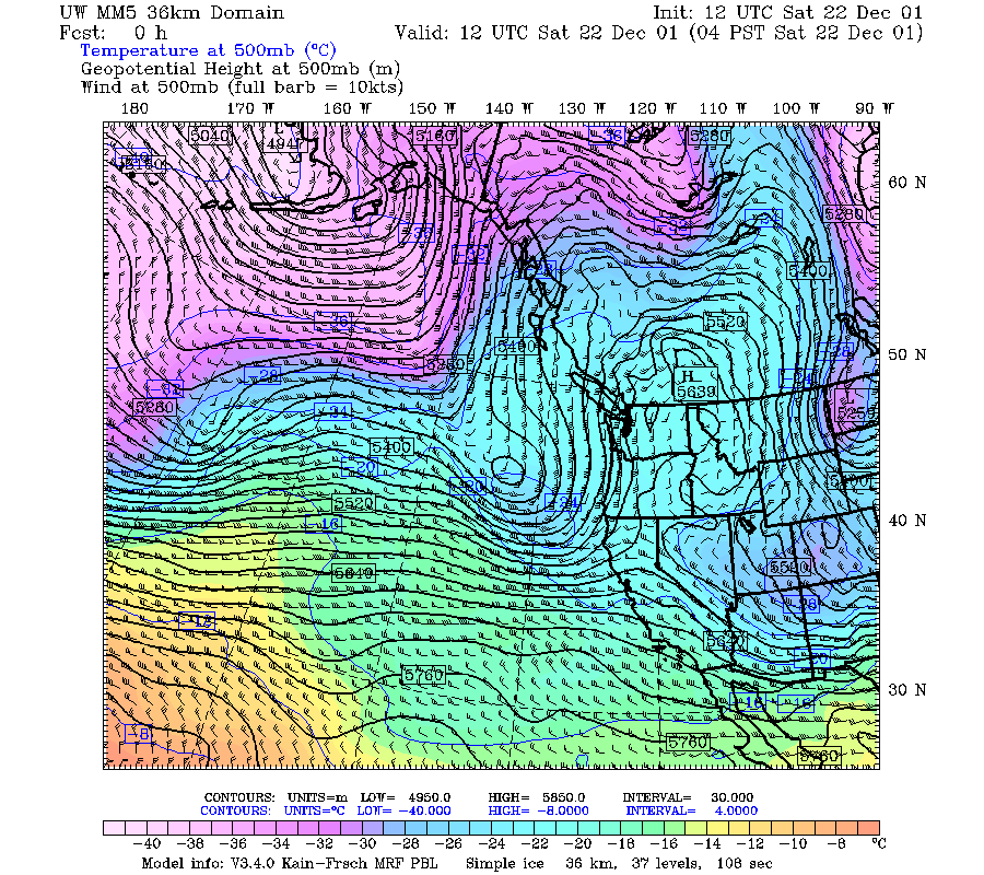
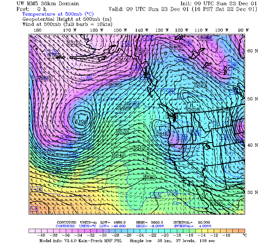
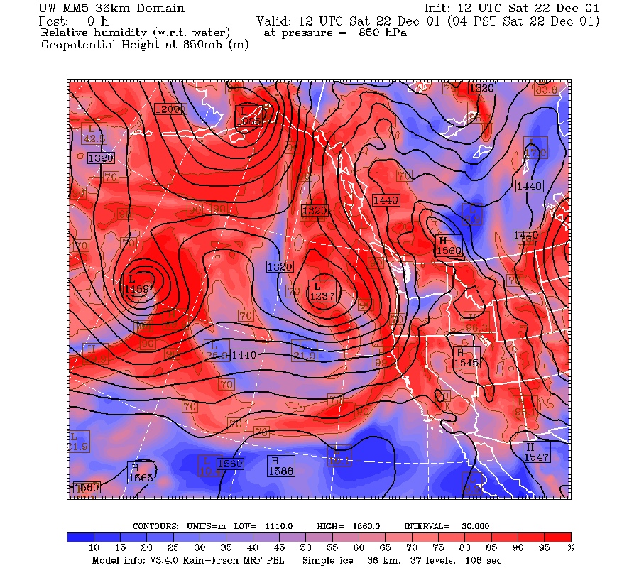
A nearly cut-off short wave at 500 mb moved into Oregon during 1200 UTC 22 December and 0000 UTC 23 December 2001 (Fig. 1a, Fig. 1b). The wind at 500 mb turned from southerly to southeasterly during this period. The wind at 850 mb was southerly and weakening during this period (Fig. 2a, Fig. 2b). The tongue of high relative humidity reached southwestward to only about 20 deg north (Fig. 3a, Fig. 3b). The west-east gradient of sea level pressure was very strong at 1200 UTC but decreased during the period (Fig. 4a, Fig. 4b). This west-east gradient favored easterly flow through the Columbia Gorge.
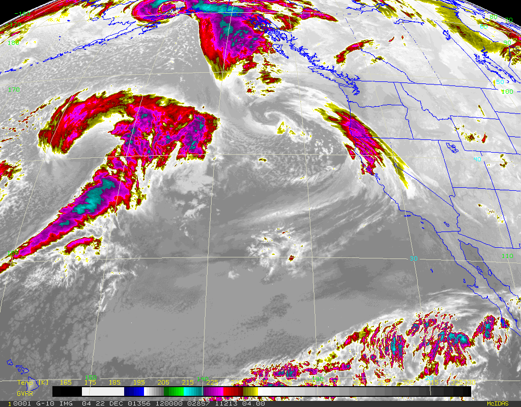
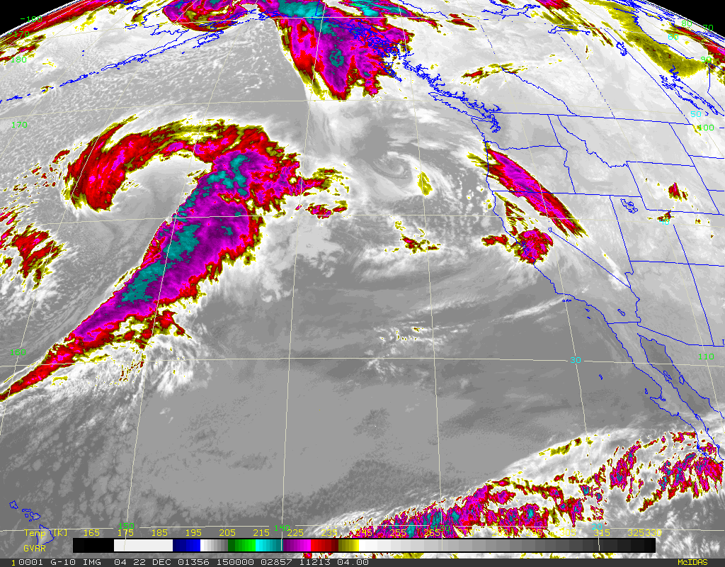
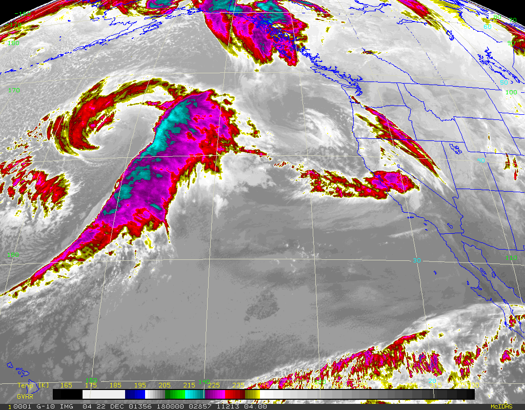
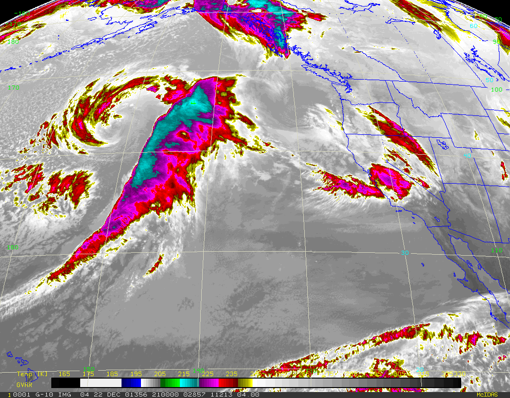
The satellite imagery showed an occluded frontal cloud band moving across western Oregon from 1200-1500 UTC 22 December (Fig. 5a, Fig 5b, Fig. 5c). At 2100 UTC, a comma cloud was moving over western Oregon (Fig. 5d).
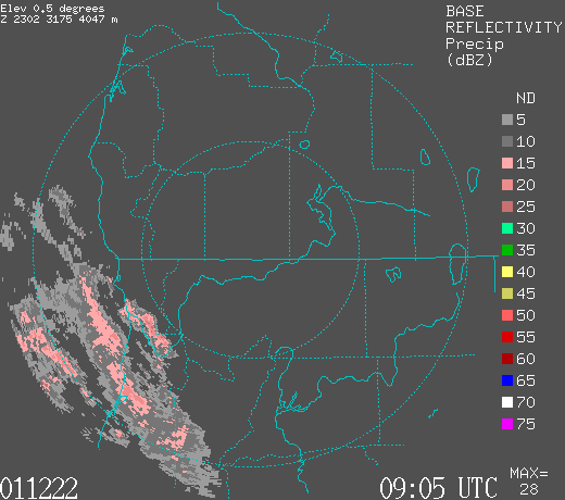
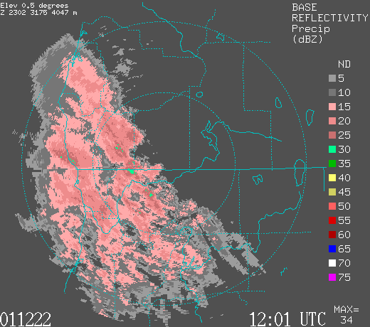
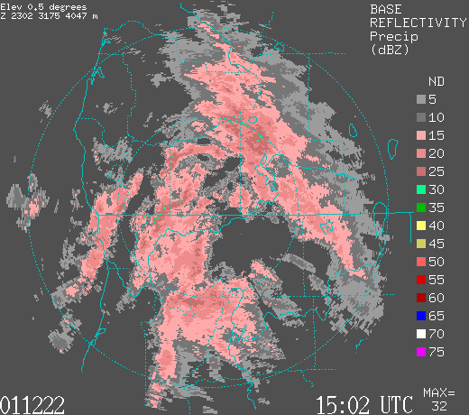
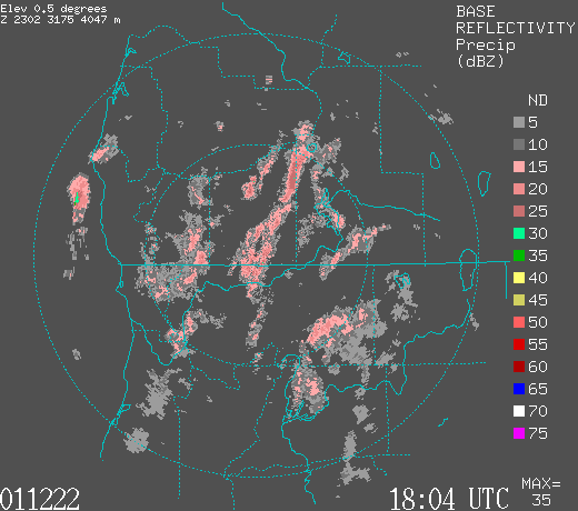
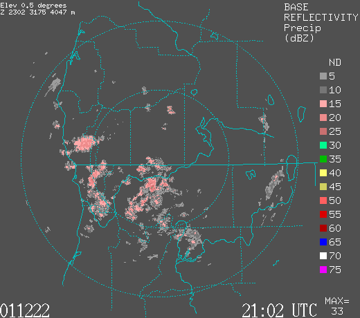
The Convair flew two flights between 1400 UTC and 2300 UTC. The Medford radar showed warm-frontal rainbands oriented NW-SE moving through western Oregon from 0900-1200 UTC (Fig. 5e, Fig. 5f). At 1500 UTC, the Medford radar showed the last warm-frontal rainband to the northeast of the radar, while the rainbands over and to the southwest of the radar were changing over to north-south oriented cold frontal rainbands (Fig. 5g). By 1800 UTC the cold-frontal rainbands were still evident but much weaker (Fig. 5h). At 2100 UTC postfrontal convective echoes, located just ahead of the comma cloud were detected to the southwest of the radar (Fig. 5i).
Convair-580 Summary
UW Flight Number:
1905
Period of Flight:
1459-1752 UTC, 22 December 2001
Main Accomplishment of Flight:
Weak warm-frontal rainband from 20,000 to 18,000 ft. Landed in Eugene, Oregon.
Instrument Problems:
PMS 1-D cloud probe (?).
Flight Scientist:
Nick Bond
Approximate UTC Timeline (Local time= UTC-8 hours) Activity for UW Flight 1905:
1459 |
Engines on. |
1509 |
Takeoff. |
1547 |
Hit clouds at ~46˚ north/123˚9'. |
1603 |
Broke out of clouds; still some small crystals from aloft. |
1612 |
Back in clouds; 2-DC temporarily out. |
1614 44˚31'/123˚35'. |
Winds 155-160˚ @ ~22 m s–1. (~5 m s–1 greater than forecast). |
1631 |
Turning for start of first leg; popped into clear briefly. |
1633 |
Start of leg 1 (northeast at 20,000 ft). Wind 168˚ @ 31 m s–1. T ~–27˚C. Sun dimly visible; only small crystals implying not much growth above. |
1648 |
End of leg 1; brighter here. |
1650 |
Start of leg 2 (southwest 20,000 à18,000 ft). |
1651 |
Dropping down to 18,000 ft due to traffic. |
1703 |
Ground becoming visible. |
1710 |
End of leg 2; shallow CBs ahead. |
1712 |
Start leg 3 (northeast 18,000-20,000 ft). |
1719 |
Intercepted cloud/precipitation. Wind 167˚ @ 25 m s-1. T ~–26˚C. |
~1728 |
End of leg 3. |
1732 |
After conversations with S-Pol radar operator decided to break off pattern and land at Eugene to wait for surface front. |
1749 |
Landed at Eugene Oregon |
1752 |
Engines off. |
UW Flight Number:
1906
Period of Flight:
1909-2300 UTC, 22 December 2001
Main Accomplishment of Flight:
1) Takeoff from Eugene, Oregon. North-south oriented profile from 20,000 to 10,000 ft in same system as UW Flight 1905.
2) Wind profile in Columbia Gorge. Landed at Paine Field, Washington.
Instrument Problems:
PMS 1-D cloud probe (?).
Flight Scientist:
Nick Bond
Approximate UTC Timeline (Local time= UTC-8 hours) Activity for UW Flight 1906:
1909 |
Engines on. |
1916 |
Takeoff. |
1931 |
In precipitation in vicinity of Santiam Pass. LWC = 0.1-0.2 g m-3. Descent in precipitation east of crest. |
1937 |
Beginning spiral ascent to 20,000 ft. |
1941 |
Leveling at 12,000 ft for traffic. |
2002 |
Getting bright above 18,000 ft. |
2004 |
First north-south run (north at 20,000 ft) near top. Wind 150˚ @ 16 m s–1. T ~–29˚C. |
2010 |
At north end; turning. |
2012 |
Start of second (south, 20,000 à 18,000 ft). |
2021 |
End of second; turning. |
2023 |
Third north-south (north at 18,000 ft). Wind 165˚ @ 18 m s-1. T ~–24˚C. |
2030 |
End of third; turning. |
2032 |
Start of fourth (south, 18,000-16,000 ft). |
2043 |
End of forth; turning. |
2045 |
Fifth north-south (north at 16,000 ft). Wind 170˚ @ 14 m s-1. T ~–20˚C. |
2052 |
End of fifth leg; turning. |
2054 |
Start of sixth (south, 16,000-14,000 ft). |
2104 |
Broke into clear slot. |
2106 |
Hit liquid H2O cloud at south end. |
2107 |
End of sixth; turning. |
2109 |
Start of seventh north-south (north at 14,000 ft). Wind 175˚ @ 12 m s-1. T ~–17˚C. |
2117 |
End of seventh leg (somewhat greater precipitation at north end. |
2119 |
Start eighth (south 14,000-12,500 ft). |
2126 |
Hit clear zone. |
2131 |
End of seventh leg. |
2134 |
Start eighth leg north-south (north 12,500 ft). Wind 225˚ @ 8 m s-1. |
2145 |
End of eighth leg. |
2146 |
Proceeding northeast and descending to 10,000 ft in very light precipitation. |
2152 |
Heading for Troutdale to do a missed approach. |
2202 |
Crossing crest at 45˚10'. Little precipitation reaching surface. |
2209 |
Winds into Troutdale at 4,000 ft, 185˚ @ 10 m s-1; 2,500 ft, 110˚ @ 15 m s-1. |
2213 |
Over runway 080˚ at 10 m s-1. |
2215 |
Rapid wind shift at 2,000 ft. with some turbulence. |
2216 |
Ferry to Paine Field. |
2257 |
Landed. |
2300 |
Engines off. |
P-3 Summary
No flight
S-Pol Radar Summary
The S-Pol radar was run continuously in the same mode of operation for the length of the field project.
Summary of Mobile Upstream Sonde Launches
Launch times at: Rowland, OR, Lat: 44.2800, Lon: -123.0650, Elev: 97 m
1720 UTC 22 Dec
1856 UTC 22 Dec
2016 UTC 22 Dec
Summary of Leeside Sonde Launches
Launch times at: Black Butte Ranch, OR (a.k.a. ISS-3), Lat: 44.379, Lon: -121.679, Elev: 1027 m
1500 UTC 22 Dec
1800 UTC 22 Dec
2100 UTC 22 Dec
Summary of NWS Sonde Launches from Salem (SLE)
Launch times:
1200 UTC 22 Dec (standard)
0000 UTC 23 Dec (standard)
Summary of Snow Crystal Ground Measurements
Measurement times: Every 15 minutes from
1500 UTC 22 Dec-2115 UTC 22 Dec (at Corbett Sno Park, Hoodoo Ski Lodge)
