IOP 5: 2-3 December 2001
Time Period of IOP
1200 UTC 2 Dec-1200 UTC 3 Dec
Overview of IOP
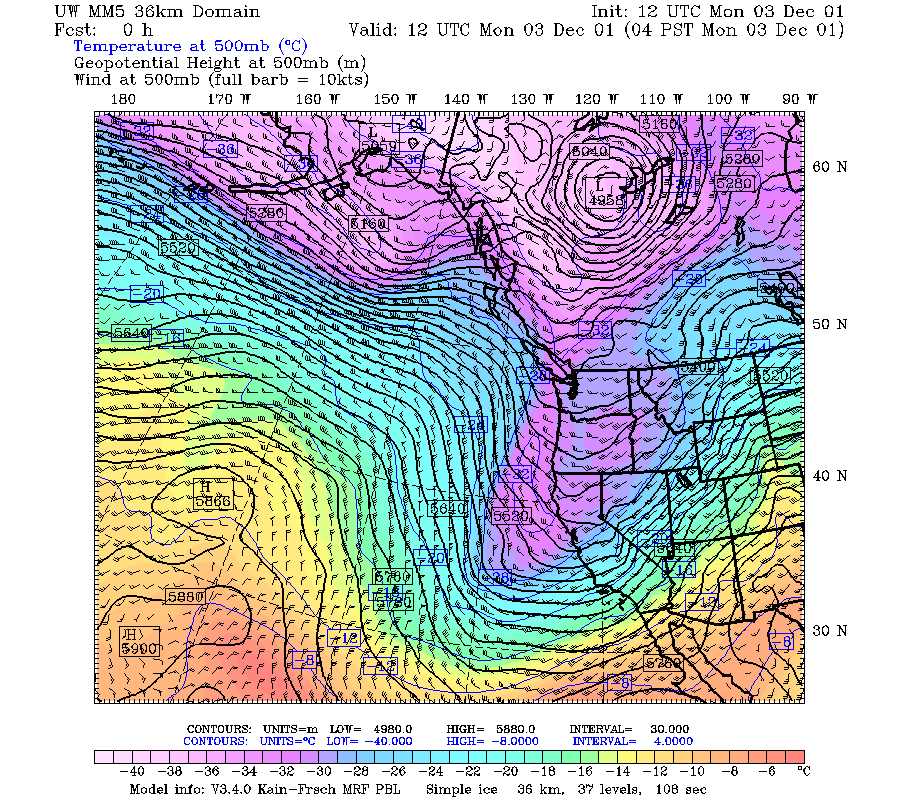
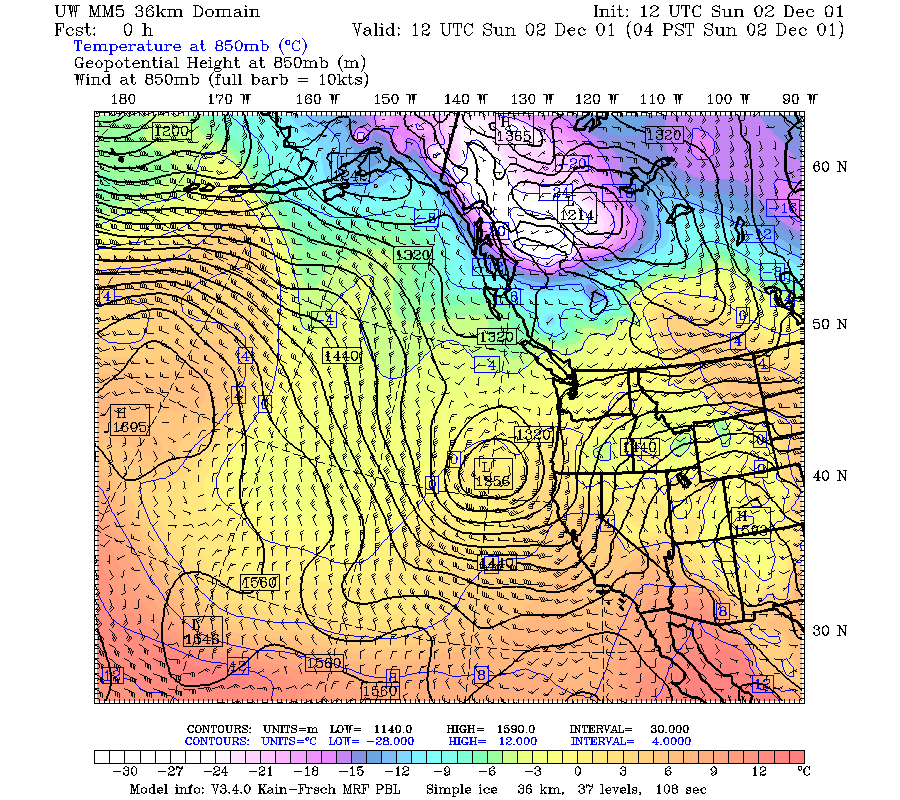
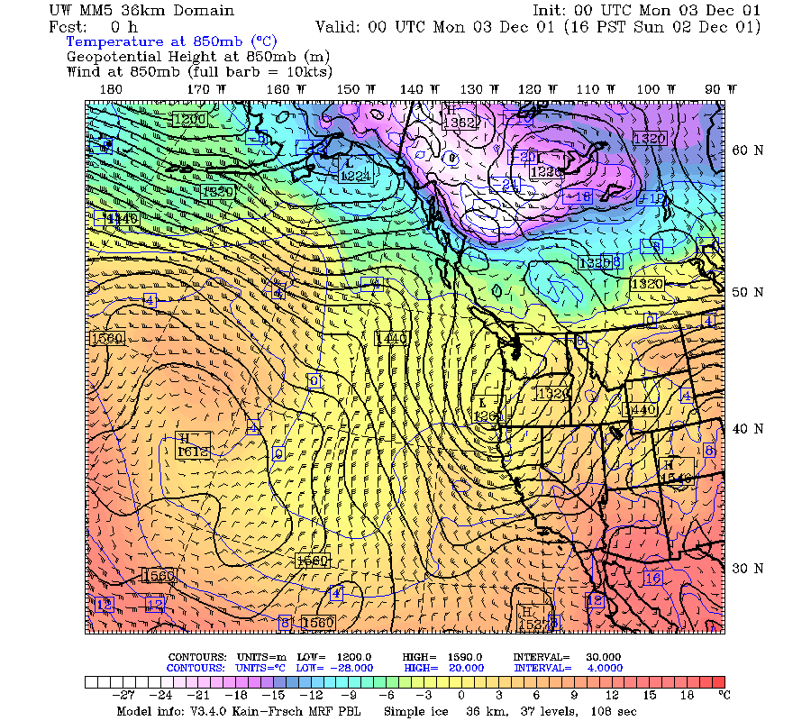
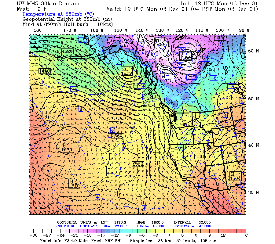
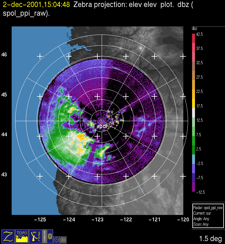
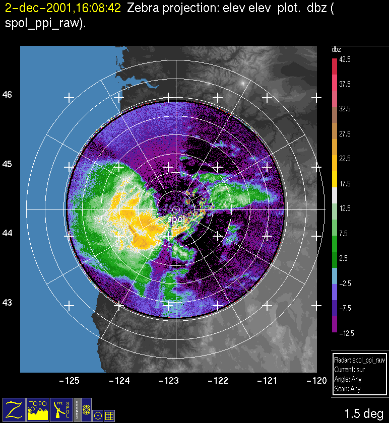
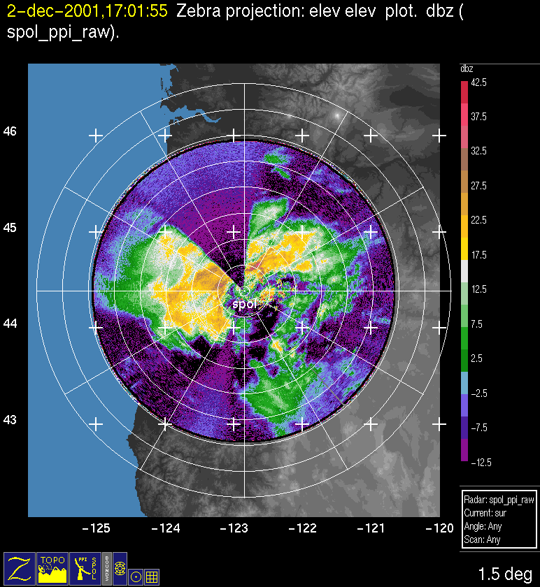
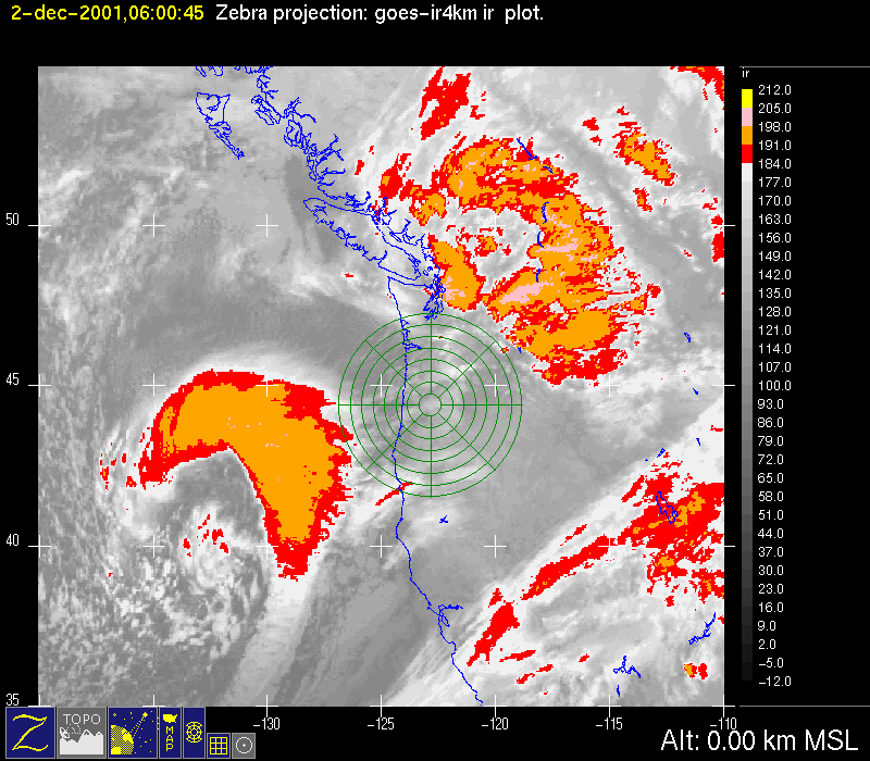
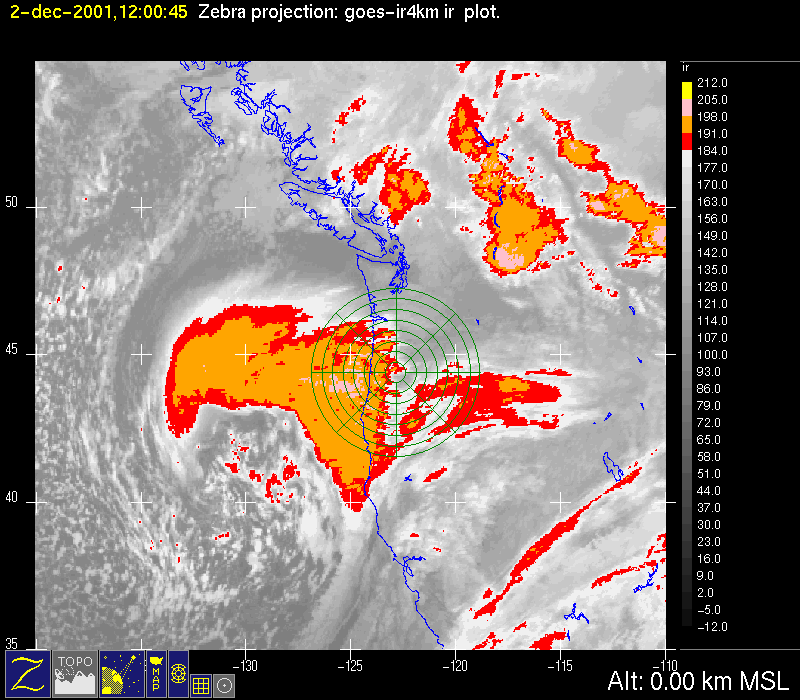
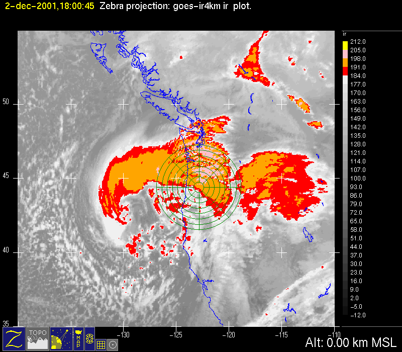
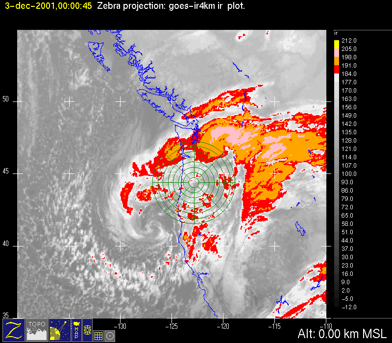
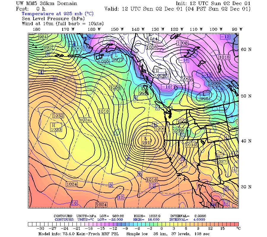
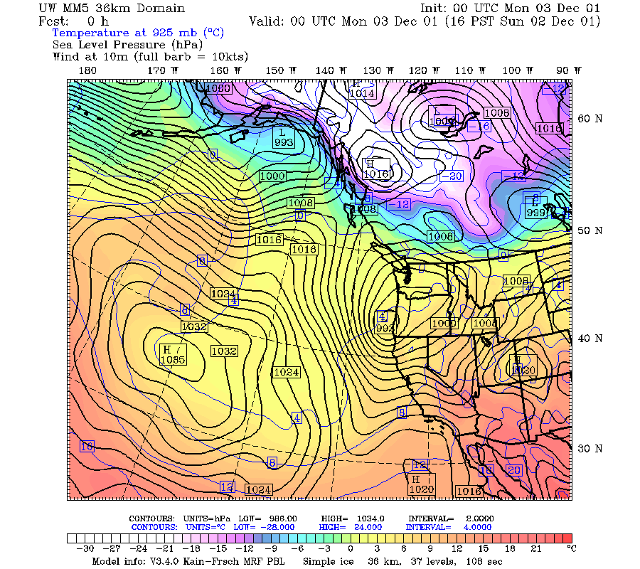
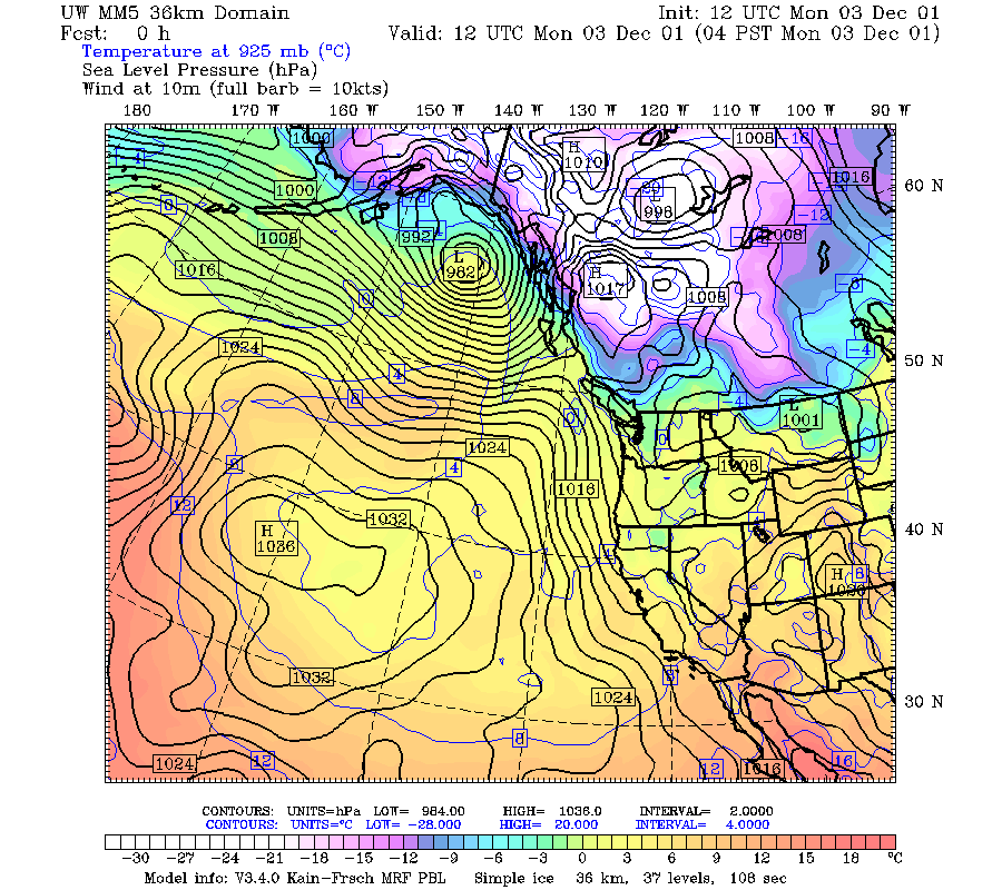
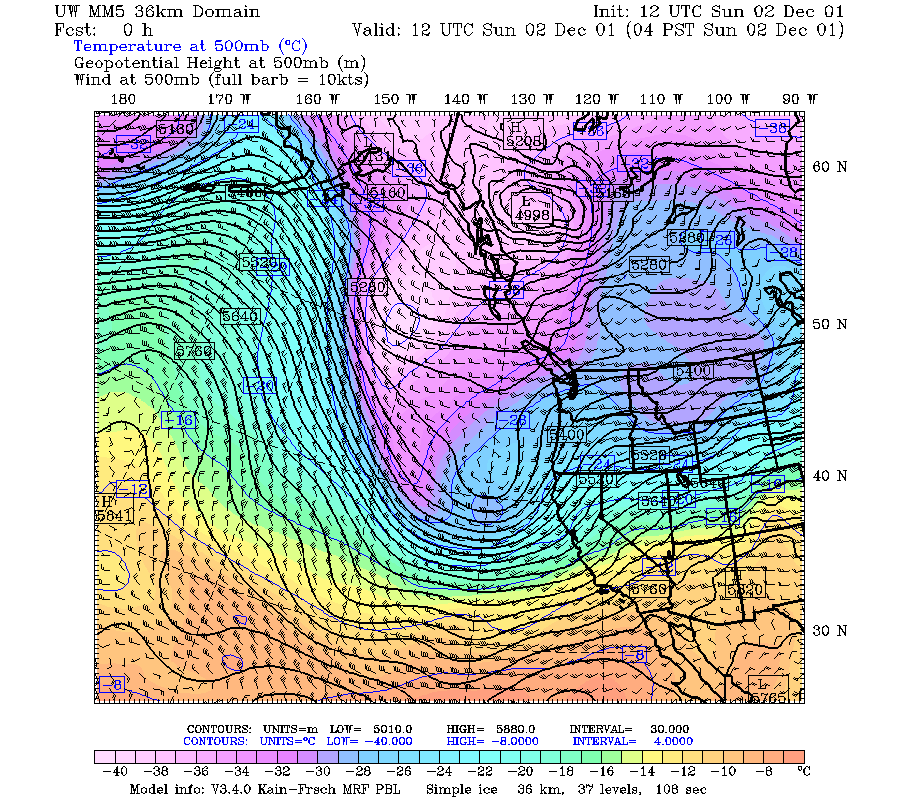
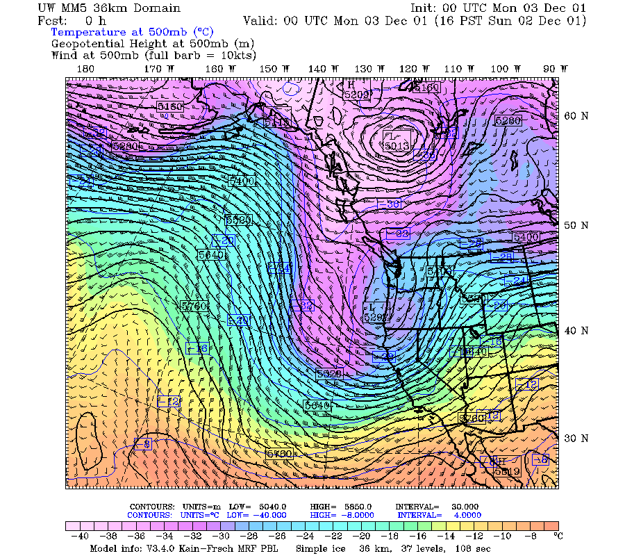
The fourth short wave in this multi-day sequence was a comma cloud, which formed in the cold air behind the main frontal zone of the long wave trough. The comma cloud was associated with a well defined 500 mb short wave trough moving toward and over Oregon from 1200 UTC 2 December 2001 to 1200 UTC 3 December (Fig. 1a, Fig. 1b, Fig. 1c). The passage at 850 mb was accompanied by the winds weakening and changing from southerly to westerly to northerly (Fig. 2a, Fig. 2b, Fig. 2c). The surface low pressure centered moved northeastward across western Oregon while rapidly weakening (Fig. 3a, Fig. 3b, Fig. 3c). The infrared imagery shows this cloud system approaching Oregon at 0600 UTC 2 December 2001 (Fig. 4a), and it moved into the radar area at 1200 UTC (Fig. 4b). By 1800 UTC it was over the Oregon Cascades (Fig. 4c), and by 0000 UTC 3 December it had moved north into Washington (Fig. 1d). The precipitation area of the comma cloud was moving over the S-Pol radar at 1500-1700 UTC 2 December. The radar echo showed this region of precipitation to be a contiguous region of weaker echo with embedded cells of moderate intensity, suggesting a convective substructure (Fig. 5a, Fig. 5b, Fig. 5c).
Convair-580 Summary
No flight
P-3 Summary
No flight
S-Pol Radar Summary
The S-Pol radar was run continuously in the same mode of operation for the entire length of the field project.
Summary of Mobile Upstream Sonde Launches
Launch times:
No Launches
Summary of Leeside Sonde Launches
Launch times:
No launches
Summary of NWS Sonde Launches from Salem (SLE)
Launch times:
1200 UTC 2 Dec (standard)
0000 UTC 3 Dec (standard)
1200 UTC 3 Dec (standard)
Summary of Snow Crystal Ground Measurements
Measurement times:
No measurements
