IOP 9: 11-12 December 2001
Time Period of IOP
1800 UTC 11 Dec-0200 UTC 12 Dec
Overview of IOP
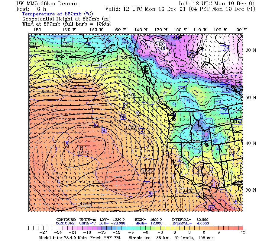
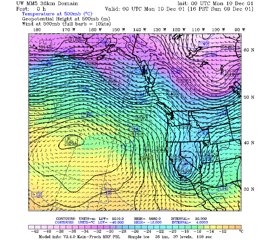
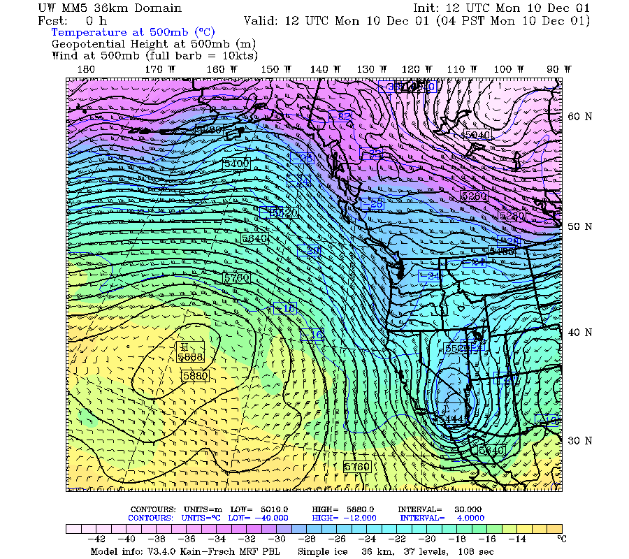
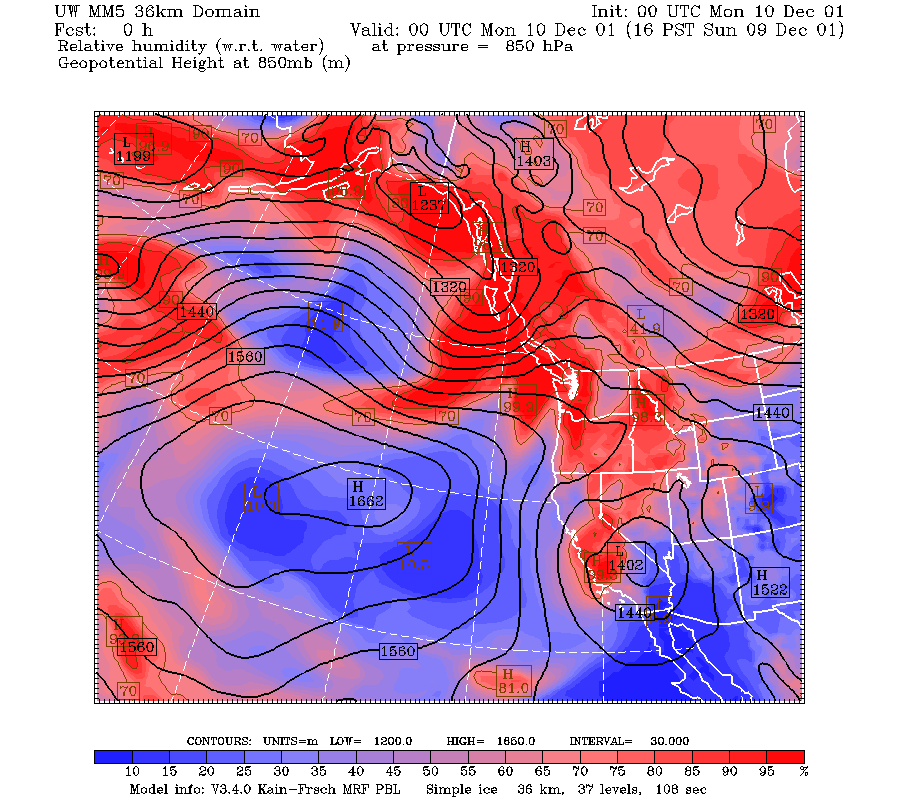
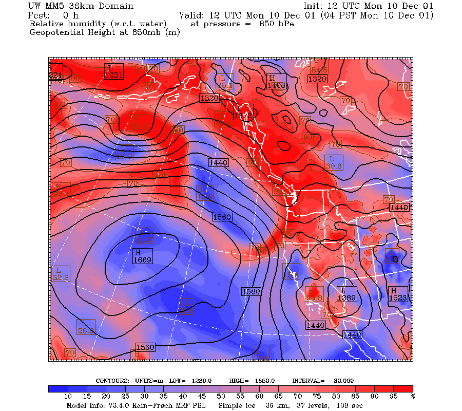
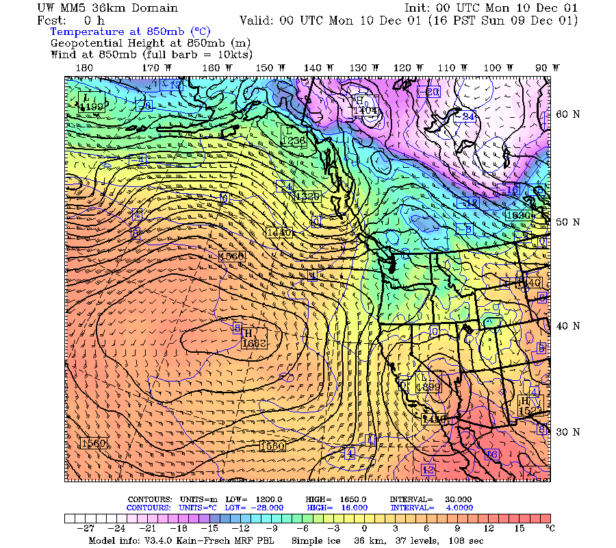
A short wave trough in the northwesterly jet moved from the northwest into Oregon at 500 mb from 0000 to 1200 UTC 10 December 2001 (Fig. 1a, Fig. 1b). The 850 mb trough moved in a similar manner, and the 850 mb wind shifted to weak westerly by 1200 UTC (Fig. 2a, Fig. 2b). The tongue of high relative humidity did not extend far south in this case (Fig. 3a , Fig. 3b).
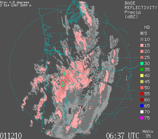
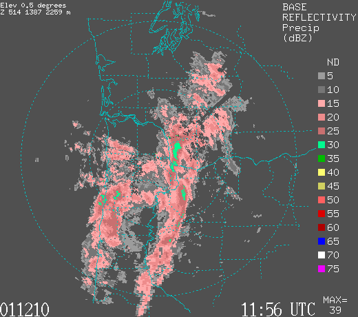
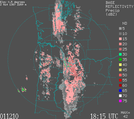
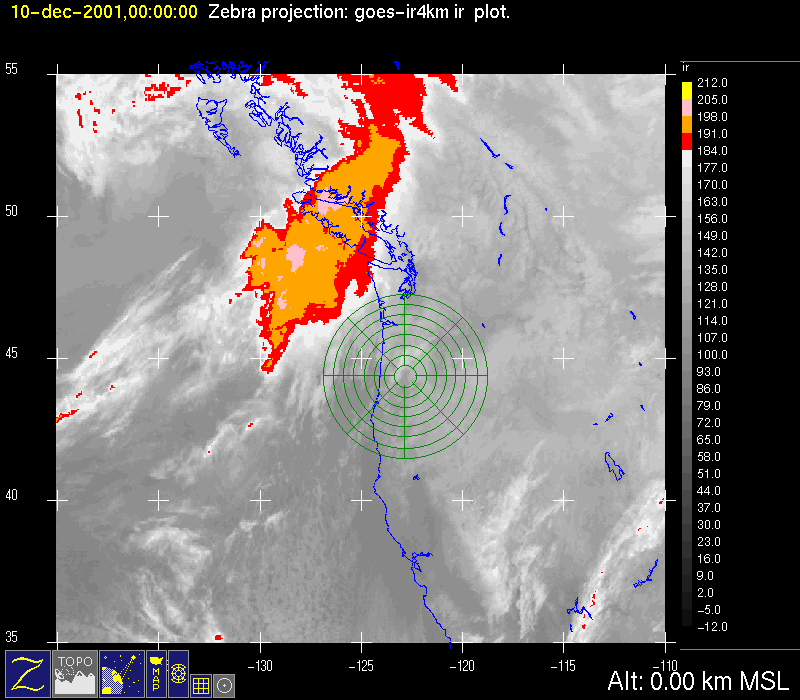
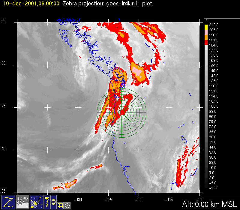
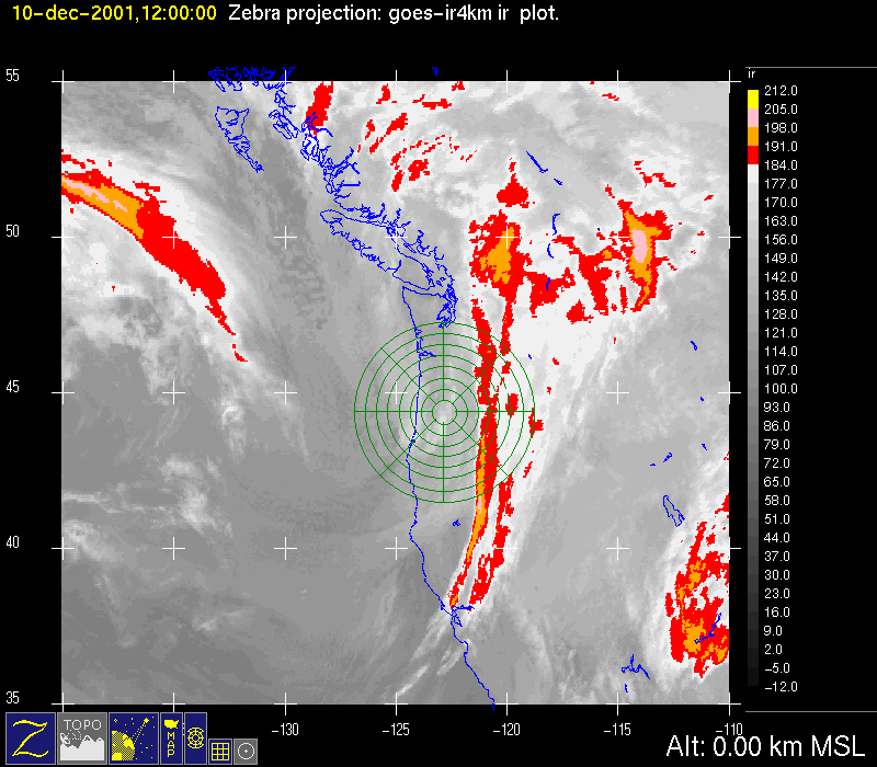
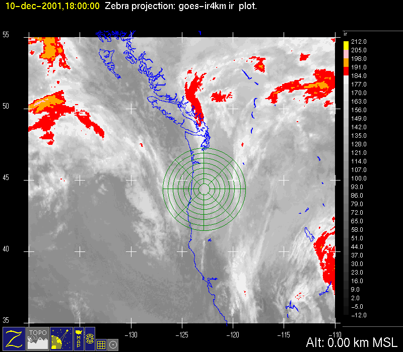
The cloud pattern associated with this short wave had a frontal structure in the infrared satellite imagery. It was approaching the S-Pol radar area from the northwest at 0000 UTC 10 December Fig. 4a and was directly over the region at 0600 UTC Fig. 4b. The Portland radar showed a broad region of continuous radar echo at 0637 UTC (Fig. 5a). By 1200 UTC, the coldest cloud top band was past the S-Pol radar area Fig. 4c. The Portland radar nonetheless showed a broad region of radar echo with postfrontal convective lines offshore (Fig. 5b). The precipitation over and to the east of the radar at this time was either frontal, orographic, or both. By 1800 UTC the infrared imagery showed mid-level cloud tops over the mountains just east of S-Pol (Fig. 4d). The Portland radar showed the orographic precipitation over the mountains distinctly at this time (Fig. 5c).
Orographic precipitation in the Oregon Cascades continued through 11 December. The Little Meadows Oregon Snotel observing site, located on the western slope of the Cascade Mountains just east of the S-Pol radar, recorded 1.6 inches of precipitation between 1200 UTC 10 December and 1200 UTC 12 December.
Convair-580 Summary
No flight
P-3 Summary
No flight
The S-Pol radar was run continuously in the same mode of operation for the entire length of the field project.
Summary of Mobile Upstream Sonde Launches
Launch times at: Rowland, OR, Lat: 44.2800, Lon: -123.0650, Elev: 97 m
2208 UTC 11 Dec
Summary of Leeside Sonde Launches
Launch times at: Black Butte Ranch, OR (a.k.a. ISS-3), Lat: 44.379, Lon: -121.679, Elev: 1027 m
1800 UTC 11 Dec
2100 UTC 11 Dec
0000 UTC 12 Dec
Summary of NWS Sonde Launches from Salem (SLE)
Launch times:
1800 UTC 11 Dec (special)
2100 UTC 11 Dec (special)
0000 UTC 12 Dec (standard)
Summary of Snow Crystal Ground Measurements
Measurement times:Every 15 minutes from
1900 UTC 11 Dec-0200 UTC 12 Dec (at Santiam Pass, Corbett, and Tombstone Sno Park)
