IOP 14: 18-19 December 2001
Time Period of IOP
1640 UTC 18 Dec-0600 UTC 19 Dec
Overview of IOP
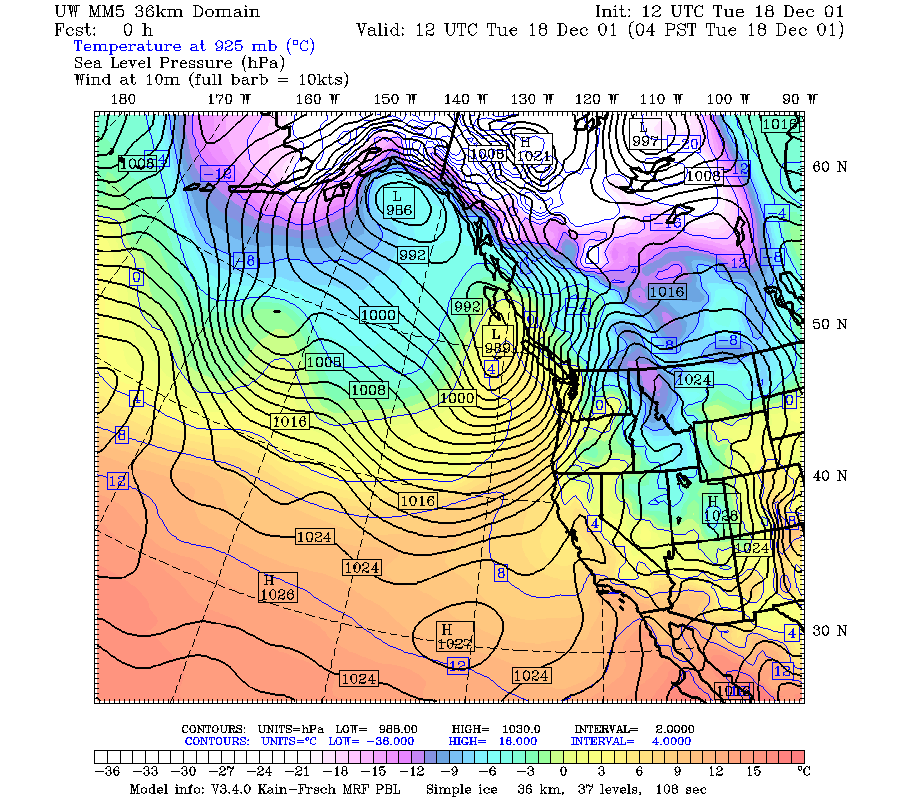
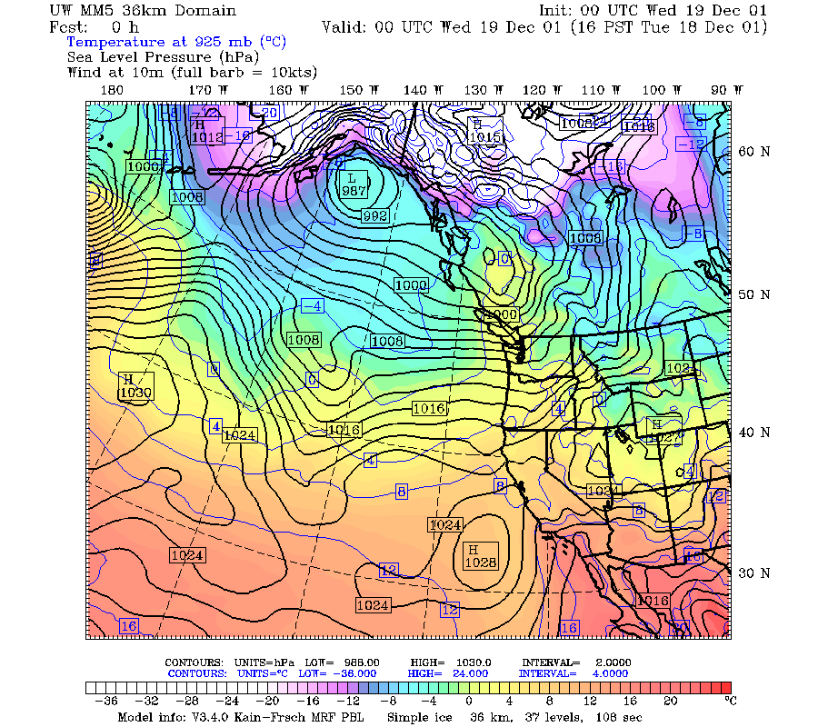
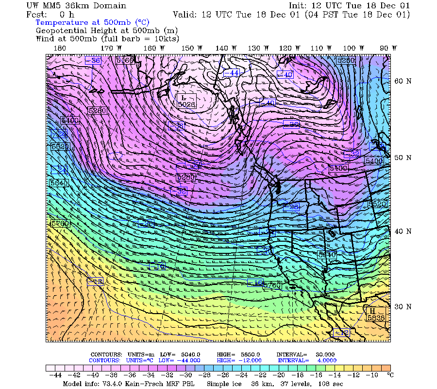
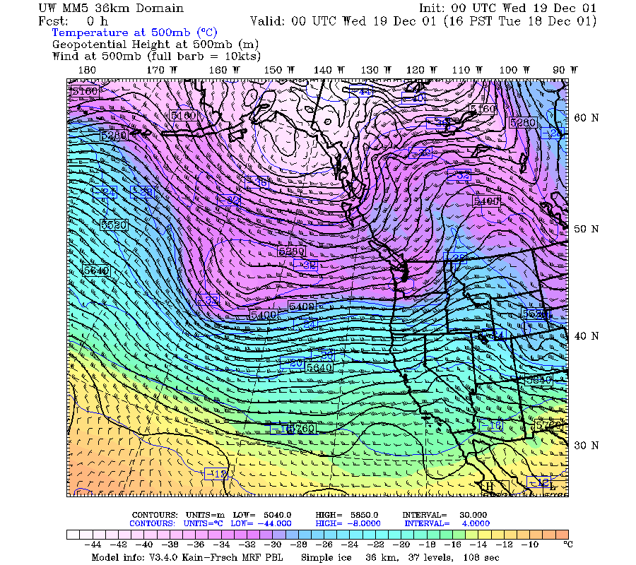
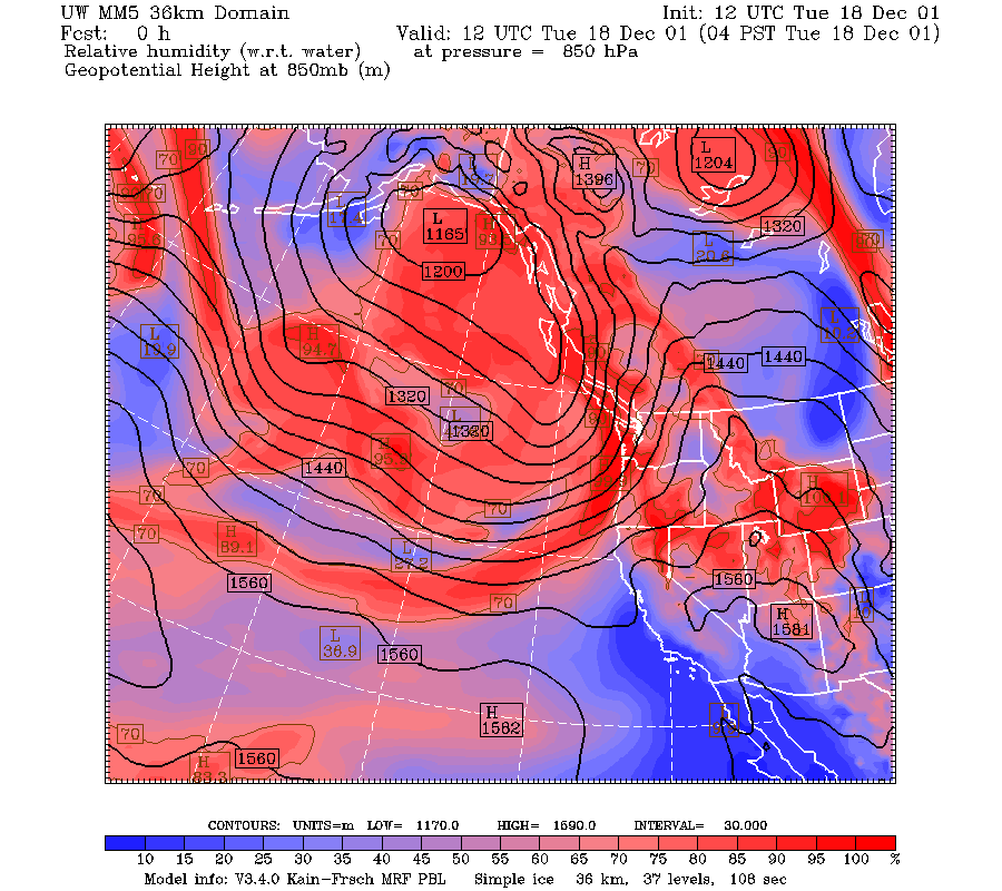
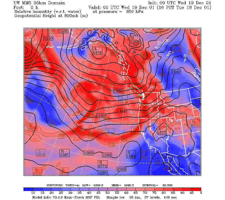
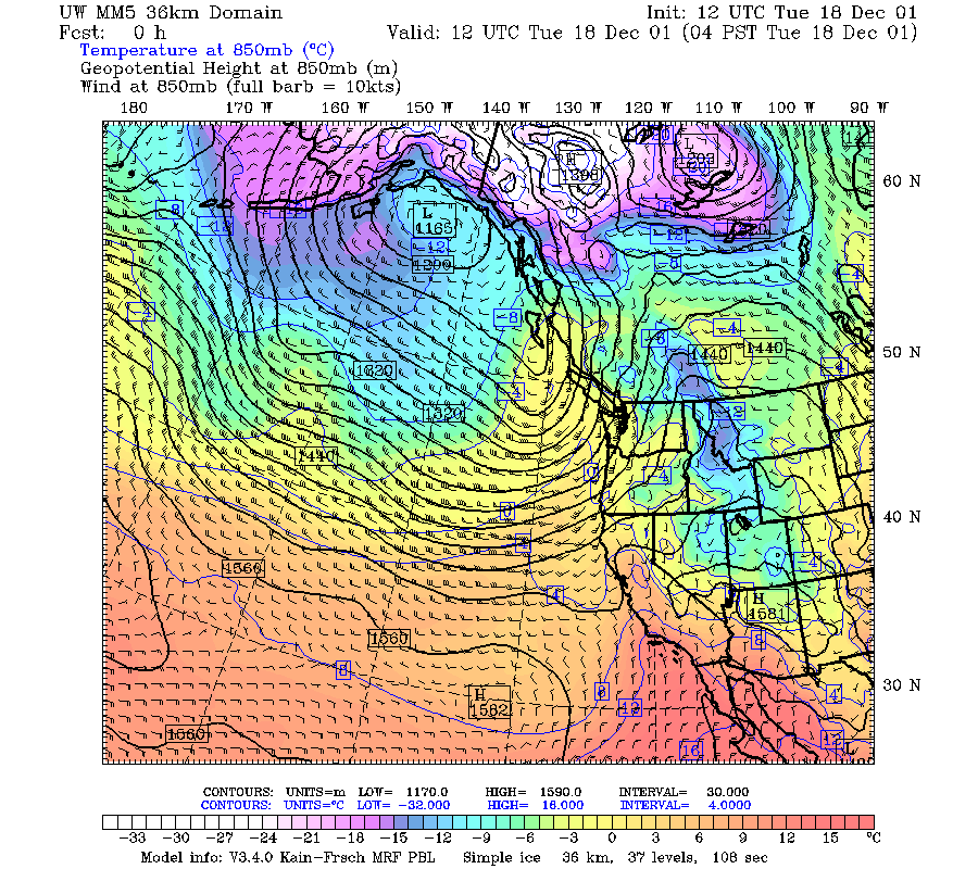
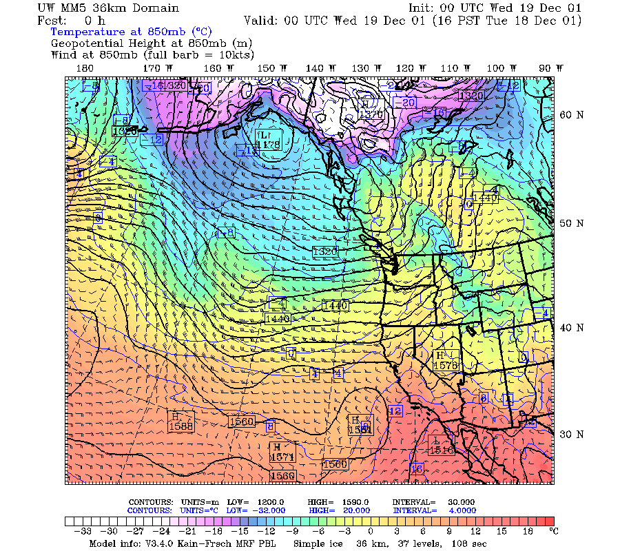
The 500 mb map for 1200 UTC 18 December 2001 showed a trough at about 130 oW approaching the Pacific Northwest coast (Fig. 1a). By 0000 UTC 19 December it had moved into Oregon (Fig. 1b). At 850 mb at 1200 UTC 18 December, the trough was well defined with moderately strong winds, but ahead of the trough, over the Oregon Cascades, the winds were only about 15 m/s from the SSW (Fig. 2a). By 0000 UTC 19 December, the 850 winds were 10-15 m/s from the SW over the Oregon Cascades (Fig. 2b). The tongue of high humidity at 850 mb did not extend south of 20 deg north (Fig. 3a, Fig. 3b). The surface map at 1200 UTC 18 December showed a moderately strong front over the ocean west of Oregon and a strong SW-NE pressure gradient across western Oregon (Fig. 4a). By 0000 UTC, the front had moved over the mountains and the pressure gradient over Oregon was weak (Fig. 4b).
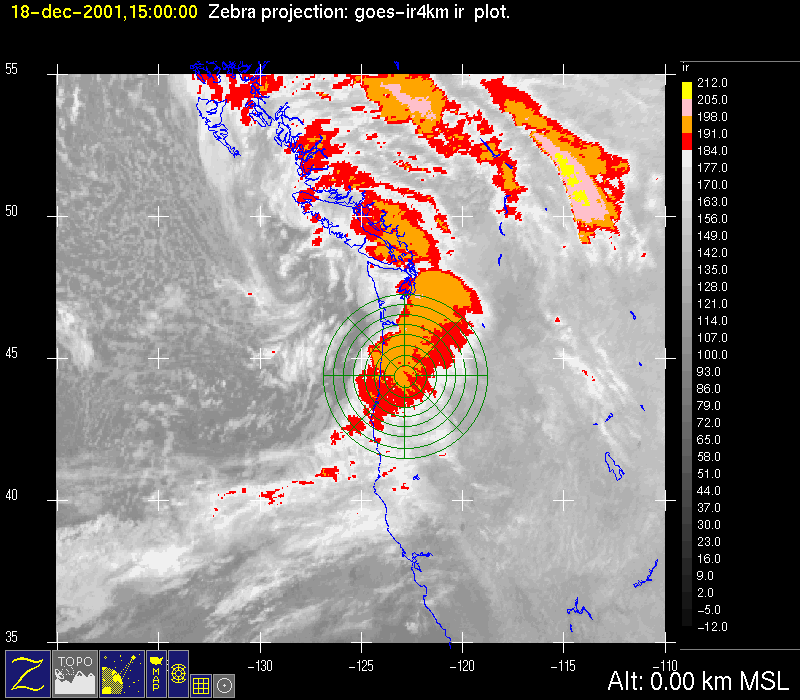
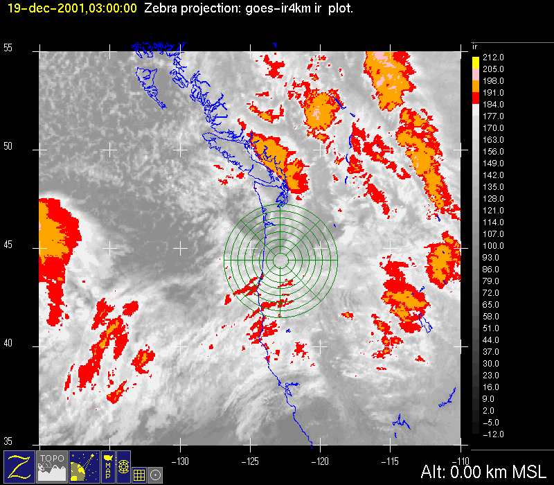
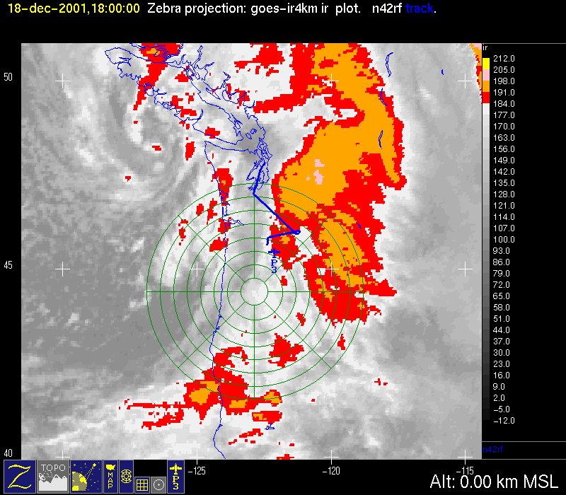
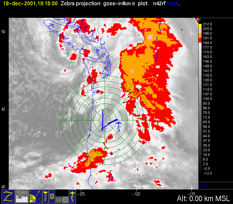
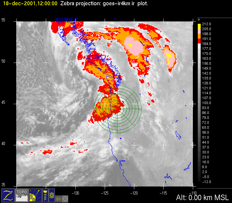
The infrared satellite imagery for 1200 UTC 18 December 2001 showed an intense frontal cloud band moving over the western portion of the S-Pol radar area (Fig. 5a). The back edge of the cold cloud top was offshore. The southwestern portion of the cloud band showed a small scale transverse banded structure, as has been seen in previous cases during the project. By 1500 UTC, the frontal cloud band was directly over the radar area, and a comma cloud was forming south of Vancouver Island (Fig. 5b).
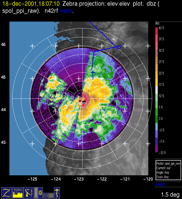
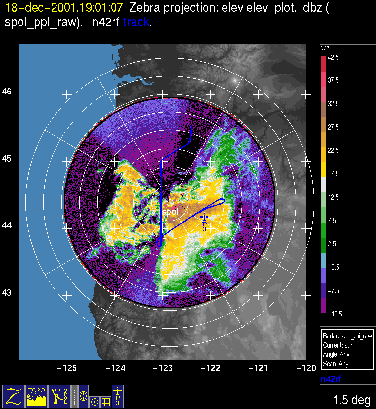
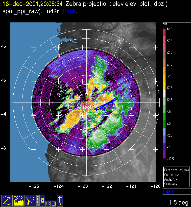
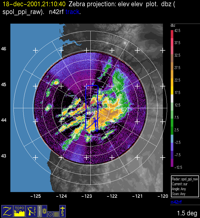
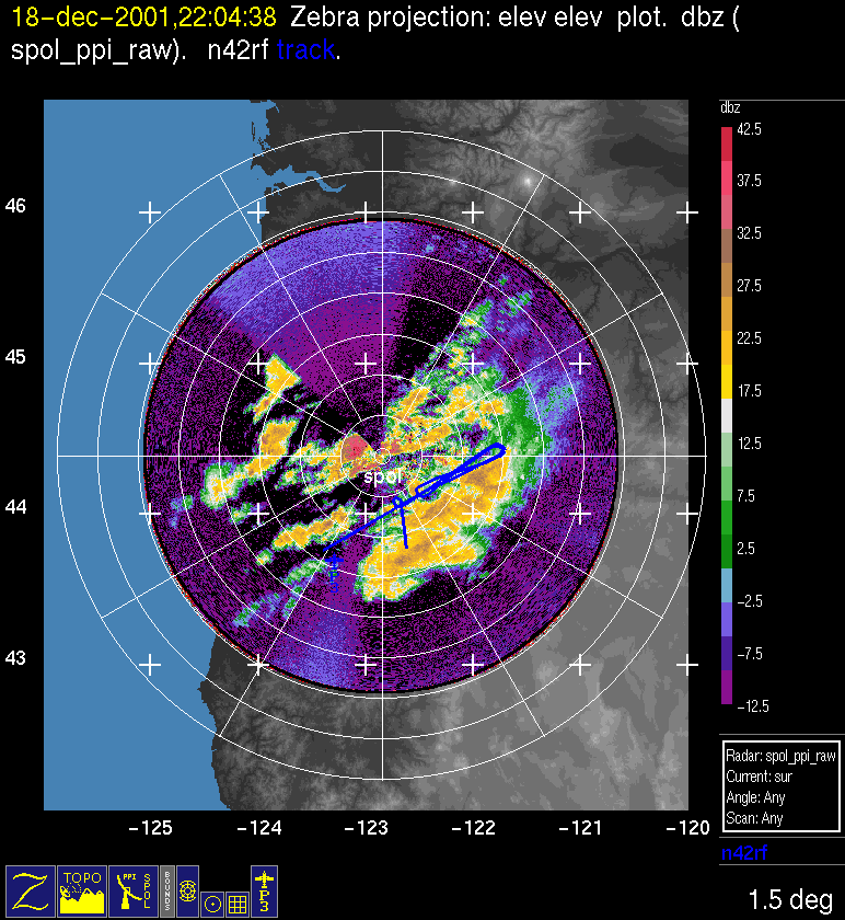
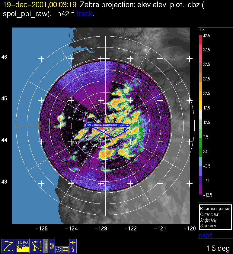
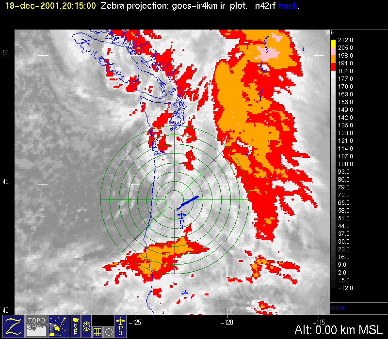
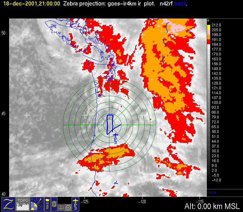
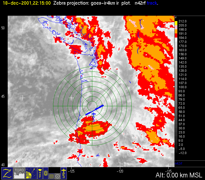
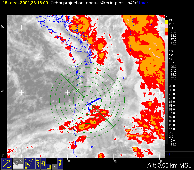
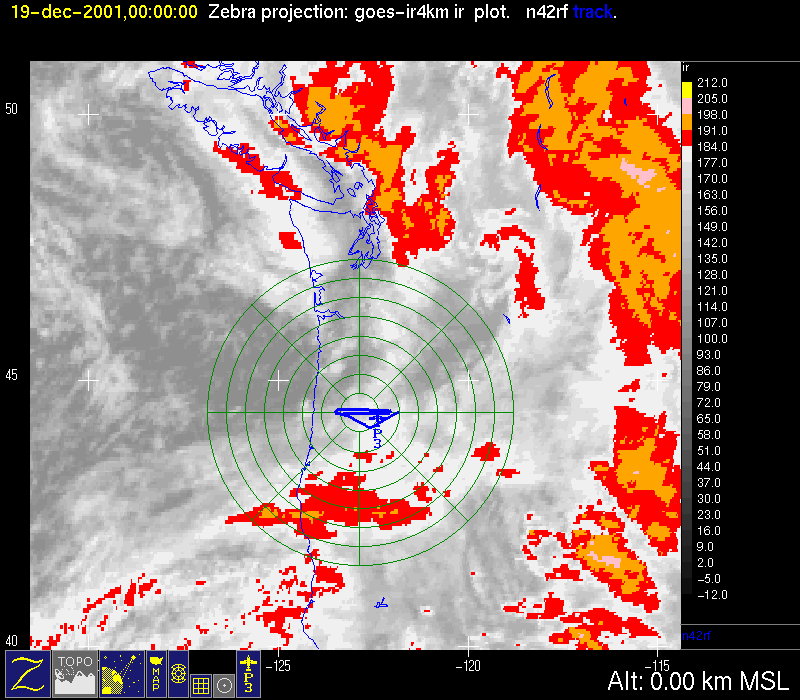
The P-3 aircraft flew from 1700 UTC 18 December-0200 UTC 19 December. The first part of the flight documented flow in the Columbia Gorge. The rear portion of the frontal cloud band was over the Gorge, with precipitation occurring and thus allowing for airborne dual-Doppler radar measurements. The aircraft therefore headed southeast out of Seattle to a point along the Columbia River and then flew WSW along the Gorge till about 1800 UTC (Fig. 5c). Then the P-3 headed south into the S-Pol radar area where they arrived about 1900 UTC (Fig. 6a). From about 1800-2000 UTC the P-3 flew a SW-NE track through the back edge of the frontal cloud and precipitation pattern over the mountains just east of the S-Pol radar (Fig. 5d, Fig. 5e). The 1.5 deg elevation echo in this region in which the P-3 was flying, had the smooth uniform appearance of stratiform snow, as has been typical of the frontal precipitation regions in previous systems seen in the project (Fig. 6b, Fig. 6c) The SW-NE oriented band of echo moving toward the radar from the west of the radar during this time period had a more convective appearance and was located in the tail of the comma cloud seen in the satellite imagery. From 2000-2300 UTC, the P-3 flew a dual-Doppler pattern in the tail of the comma cloud (Fig. 5f, Fig. 6d). The comma cloud was extremely prolific producer of liquid water (multiple excursions above 0.5 g/m**3) and moderate-to-severe icing. As the P-3 flew in the tail of the comma cloud, another cloud band, separated from the tail of the comma by a relatively clear gap in the satellite image, was moving in from the west (Fig. 5e , Fig. 6e, Fig. 5f). By 0000 UTC 19 December, the comma cloud was east of the Cascades, and the P-3 was flying in the next cloud band as it moved over the mountains (Fig. 5g, Fig. 6f). From the viewpoint of the P-3 this latter part of the flight pattern was described by Brad Smull as, "cold-core showers congealing into a more continuous though shallow precip shield as they piled into the Cascades." The shoulder of the next warm-frontal cloud pattern was in the southwest part of the S-Pol radar area. By 0300 UTC the regime over the S-Pol radar was generally postfrontal, with the shoulder of the next warm-frontal pattern still in the southwest quadrant of the radar area (Fig. 5h).
Convair-580 Summary
No Flight
P-3 Summary
P-3 Flight Number:
011218H, IMPROVE 08
Period of Flight:
1640 UTC 18 December-0156 UTC 19 December 2001
Main Accomplishment of Flight:
The P-3 took measurements in the Columbia River George in easterly flow, then flew south to the IMPROVE area to take further measurements.
Instrument Problems:
-
Flight Scientist:
Nick Bond
Approximate UTC Timeline (Local time= UTC-8 hours) Activity for P-3 Flight 08:
164021 UTC (47.90018, -122.28056) 187.461°, 984.3 mb, 6728.0 m Scientists in seats
164639 UTC (47.90016, -122.28053) 189.691°, 985.1 mb, 0.0 m Block-out
165656 UTC (47.91212, -122.28571) 179.011°, 986.3 mb, 0.0 m Takeoff Rwy 16R
170322 UTC (47.68405, -122.58386) 205.962°, 722.3 mb, 2636.0 m Radar system up & recording
172256 UTC (46.69894, -122.45473) 133.855°, 567.1 mb, 3729.0 m Very continuous stratiform precip along our track, echo top ~4 km
173711 UTC (45.99378, -121.41220) 134.405°, 567.6 mb, 3646.0 m Descending for gorge run. Echo still very continuous but weak, peaks ca. 20-25 dBZ. Beautiful cloud physics profile, rimed stellars.
174220 UTC (45.98515, -121.35172) 256.281°, 747.1 mb, 1865.0 m Level at freezing level 8kft/2.5 km, approaching gorge, precip still solid, a bit deeper than near Puget Sound, echo top ca 5 km, tracking along gorge
175002 UTC (45.89145, -121.94844) 257.064°, 747.1 mb, 1892.0 m Nearing west exit of gorge, echo remains continuous, tail Doppler data quality look excellent
175344 UTC (45.84782, -122.20552) 255.374°, 746.8 mb, 1606.0 m Tail radar back up after ~3min gap. Must have jinxed it w/ last comment...
175523 UTC (45.82664, -122.32658) 256.754°, 747.0 mb, 2060.0 m Turning to track 185. Planning south-bound run to Pt F and an abbreviated microphysics stack prior to Convair's arrival
180558 UTC (45.29343, -122.43539) 206.398°, 775.6 mb, 1930.0 m Climbing for south-bound run.
181104 UTC (45.16316, -122.71799) 235.741°, 640.9 mb, 3546.0 m Leveling at FL 120. Echo much reduced, patchy, thin mid-level layer at/just above FL.
181339 UTC (45.08992, -122.87631) 236.949°, 641.3 mb, 3538.0 m In sunshine. S-POL reports that first band is narrow & exiting area, however comma-cloud moving in from west
181545 UTC (45.02713, -123.01631) 230.996°, 641.7 mb, 3532.0 m At Pt A,. LF suggests widespread precip to our west beyond 100 km, but may be getting some sea clutter return as well.
181919 UTC (44.82338, -123.03435) 179.223°, 641.7 mb, 3403.0 m Seeing some 2nd trip return. Flight level wind speeds jumping up here in clear.
182056 UTC (44.73415, -123.02849) 174.951°, 641.6 mb, 3534.0 m Radar down briefly, back up at 1822:03
182503 UTC (44.50752, -123.03520) 183.449°, 641.7 mb, 3517.0 m Radar down again, back up at 1827:20. Echo picking up again, but not too widespread. More structure, suggestion of fallstreaks off RHS at 1828-29.
183452 UTC (43.92133, -123.03767) 177.886°, 641.7 mb, 3456.0 m Considering possibility of microphysical spiral (vs. Stack) through band to expedite sampling before it exits study area. Echo tops now 5-7 km.
183823 UTC (43.73472, -123.08307) 304.192°, 640.8 mb, 3200.0 m At Pt F, tracking toward north.
185220 UTC (44.44820, -121.78845) 79.123°, 514.1 mb, 4008.0 m Turning planning 200 ft/min from 17.5 to 15 kft for "short-stack" leg back to SW. Mass says comma is moving in quickly, makes for excellent/unique mission objective, so we'll expedite stack in order to be back in lawn-mower pattern for comma cloud arrival.
190720 UTC (44.23783, -122.37680) 67.458°, 568.9 mb, 3681.0 m Echo remains solid Now tracking NE
191404 UTC (44.39368, -121.78415) 253.015°, 579.5 mb, 3087.0 m Turning to track SW, descending on this leg. LF is showing signs of distinct north-south band
192306 UTC (44.16237, -122.43259) 288.319°, 628.9 mb, 2950.0 m Turning to track NE at 10 kft.
192733 UTC (44.33087, -122.06317) 56.763°, 629.4 mb, 2496.0 m Track adjustment. Coastal range terrain & lower altitude partially blocking LF view of approaching band (comma cloud?) but
193255 UTC (44.48905, -121.56305) 221.065°, 629.5 mb, 2545.0 m Turning to track SW
194013 UTC (44.31584, -122.04581) 239.107°, 679.8 mb, 2340.0 m Re-booting radar system. Recording back on at 1941.
194434 UTC (44.20309, -122.32155) 241.280°, 694.5 mb, 2095.0 m Seeing echo enhancement over sloped terrain on RHS.
194641 UTC (44.21304, -122.42740) 30.452°, 695.0 mb, 2189.0 m Turning to track NW. Echo fell off rapidly neat this end of stack, clouds looked more convective w/ blue sky surrounding. Bond notes that liquid water concentrations bumped up to 0.4-0.5 g/kg near SW end of track; picked up a lot of rime ice
195537 UTC (44.49869, -121.56516) 196.384°, 695.0 mb, 1776.0 m Turning to track SW, descending slowly to 6kft if possible. Ultimately climb to 17.5 kft and track to Point F (or location identical to IP)
200331 UTC (44.31933, -122.06152) 239.638°, 707.3 mb, 1680.0 m Nearing SW point, again more convective character visually
200922 UTC (44.17089, -122.41576) 216.541°, 751.6 mb, 1654.0 m SW point, tail down at 20:09:30, re-booting. Back up & recording 20:11. Continued eidence of orographic enhancement NW of our track. Descending to 6 kft as we near Pt F.
202402 UTC (44.06465, -123.03087) 2.049°, 812.0 mb, 1661.0 m On north-bound track F--->A. S+ (heavy snow) at flight level. King probe continues to show appreciable liquid water (ca. 0.5 g/kg) yet tail radar indicates only stratiform structure.
202755 UTC (44.32046, -123.01698) .582°, 812.0 mb, 1526.0 m Echo weakening. But thereafter quite cellular in patches
203743 UTC (44.97674, -123.02823) 11.706°, 811.9 mb, 1725.0 m At Pt A, re-booting radar at 2039; back up at
204447 UTC (44.84671, -122.55753) 184.552°, 750.6 mb, 1617.0 m Tracking B-->G at 8 kft.
205318 UTC (44.34588, -122.55576) 178.095°, 750.1 mb, 1638.0 m Echo filling in as we approach north edge of band. Good orographic enhancement on LHS.
205921 UTC (43.98380, -122.56822) 179.863°, 750.7 mb, 1843.0 m King-probe liquid water has again increased to ca. 0.5 g/m**3. Cloud physics data shows nice riming. Tail Doppler shows only moderately deep (4 km) but solid radar echo.
210338 UTC (43.73866, -122.57130) 234.492°, 750.3 mb, 1617.0 m Turning at Pt G to track north to intercept track for microphysics stack
211007 UTC (44.10764, -122.71889) 251.578°, 562.0 mb, 4092.0 m Climbing to 17.5 kft.
211442 UTC (44.20441, -122.34384) 55.765°, 514.7 mb, 4175.0 m Out of ice, terminating climb
213303 UTC (44.15630, -122.52612) 171.907°, 590.8 mb, 3866.0 m Back in seat after taking multiple photos of mod/severe rime ice accumulations on windscreen, spinners. Present flight level is near echo top. Approaching SW point.
213439 UTC (44.15184, -122.38374) 50.417°, 591.2 mb, 3529.0 m Turning to track 050 at flight level 11 kft
214110 UTC (44.45158, -121.75676) 117.525°, 591.6 mb, 2990.0 m At Santiam Pass, turning to track 240o.
215026 UTC (44.19232, -122.33676) 247.228°, 668.2 mb, 2454.0 m Finally lost precip probe (iced up) at 2245. Plan is to descend at SW point to drop off appreciable ice load. Aircraft is shimmying, lots of banging as ice breaks off and hits fuselage/windows. Contemplating quick run to ocean to descend and melt off this crap. Radar continues to work well.
220322 UTC (43.79528, -123.31104) 240.508°, 841.8 mb, 1308.0 m At 5 kft over Wilammette, nice cellular (presumably open-cellular postfrontal) convection, anvil structures. All ice has been shed from airframe. Climbing to 12 kft & reversing course at 2208. Cloud & precip probes both working well again.
221505 UTC (43.97646, -122.95691) 64.999°, 645.0 mb, 3416.0 m Cruising through tops of convection at flight level 12 kft. Tail radar velocities have been somewhat noisier. Will try re- setting COHO.
224212 UTC (44.17358, -122.44063) 321.275°, 696.0 mb, 2460.0 m At far NE point in stack @ 10 kft, echo very shallow, not much in way of in situ microphysics data for much of this leg, though tail Doppler shows evidence of *shallow* orographic enhancement.
225518 UTC (44.50709, -121.50473) 264.558°, 673.2 mb, 2214.0 m Tail down. Back up at 2257. Echo has been on wane. Some light shallow stuff over hills
231356 UTC (44.19987, -122.82361) 299.588°, 575.1 mb, 4231.0 m At end of leg. Heading NW to pick up east-west track. Planning three legs: 15, 12.5 & 10 kft
232254 UTC (44.45208, -123.40541) 85.435°, 571.8 mb, 4351.0 m In solid echo
232632 UTC (44.44413, -122.97610) 91.872°, 571.4 mb, 4170.0 m Echo reduced, but still observed in patches.
233540 UTC (44.36935, -122.11624) 269.865°, 578.6 mb, 3018.0 m Briefly considered moving this stack west to coastal range where yet another band is approaching, but as echo has picked up somewhat have elected to remain close to S-POL.
233929 UTC (44.36725, -122.43269) 268.906°, 588.5 mb, 3544.0 m Some 2nd trip echoes even in single-PRF. Planning to run dual-PRF next leg. Return leg will be at 12.5 kft
235052 UTC (44.36387, -123.41676) 269.137°, 630.3 mb, 3610.0 m Turning to track 090. Switching radar to MEAPRS1 dual-PRF setup (3200/2133).
000733 UTC (44.44151, -121.78403) 115.379°, 630.7 mb, 2440.0 m Turning to track 270, will do slow descent to 10kft. Opting to stay in dual-PRF
001940 UTC (44.38986, -122.70425) 268.589°, 676.3 mb, 3025.0 m Cutting thru tops of weak cells. Considerable 2nd trip contamination, esp. On RHS. Completing our slow descent to 10 kft.
002426 UTC (44.39230, -123.10486) 269.924°, 694.5 mb, 2935.0 m Turning to track 092 at 10 kft.
003746 UTC (44.43443, -121.82796) 91.989°, 694.8 mb, 1505.0 m Turning for final west-bound leg (track 271); will maintain minimum possible altitude this run. Next lower will be 8 kft.
004511 UTC (44.38008, -122.27180) 271.143°, 722.0 mb, 1420.0 m Descending to 8 kft. Have been punching some reasonably well-defined cells, but nothing too rough turbulence wise yet.
004717 UTC (44.38010, -122.44267) 269.811°, 737.4 mb, 1940.0 m Out of 8.5 kft for 7kft. Continued cellular enhancement of terrain-hugging ~stratiform echoes, only ~2 km deep. Cleared to 6kft, out of 7.2 kft at 0050.
005427 UTC (44.50030, -122.91034) 356.165°, 727.2 mb, 2550.0 m Completed leg. Climbing/turning for ferry home to KPAE.
013620 UTC (47.94588, -122.41412) 8.407°, 874.8 mb, 1067.0 m Radar system secured.
015047 UTC (47.91921, -122.28581) 180.372°, 990.2 mb, 2.0 m Landed 16R
015623 UTC (47.90021, -122.28062) 256.952°, 988.2 mb, 1.0 m Block-in. Block-to-block duration 9.2 h
S-Pol Radar Summary
The S-Pol radar was run continuously in the same mode of operation for the entire length of the field project.
Summary of Mobile Upstream Sonde Launches
Launch times at: Creswell, OR, Lat: 43.9200, Lon: -123.0250, Elev: 165 m
1822 UTC 18 Dec
2137 UTC 18 Dec
0044 UTC 18 Dec
Summary of Leeside Sonde Launches
Launch times at: Black Butte Ranch, OR (a.k.a. ISS-3), Lat: 44.379, Lon: -121.679, Elev: 1027 m
1800 UTC 18 Dec
2100 UTC 18 Dec
0000 UTC 18 Dec
Summary of NWS Sonde Launches from Salem (SLE)
Launch times:
1800 UTC 18 Dec (special)
2100 UTC 18 Dec (special)
0000 UTC 19 Dec (standard)
0300 UTC 19 Dec (special)
0600 UTC 19 Dec (special)
Summary of Snow Crystal Ground Measurements
Measurement times:Every 15 minutes from
1700 UTC 18 Dec-0100 UTC 19 Dec (at Santiam Pass and Corbett Sno Park)
